|
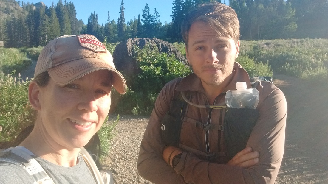
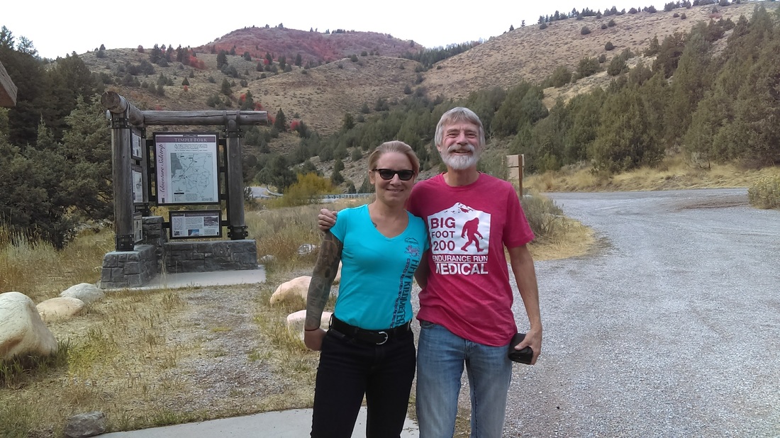
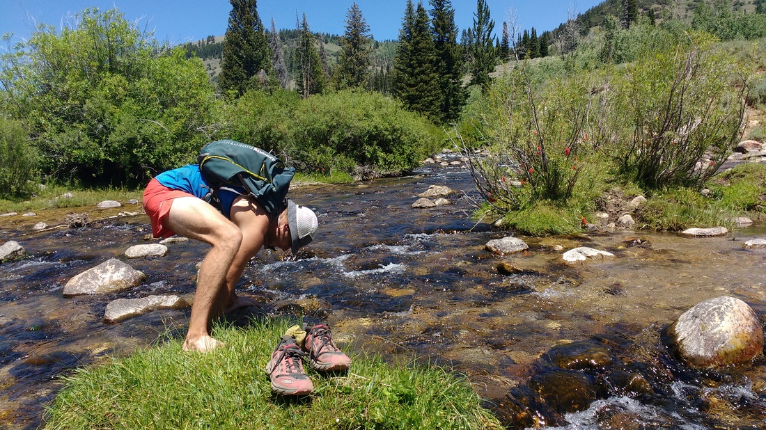
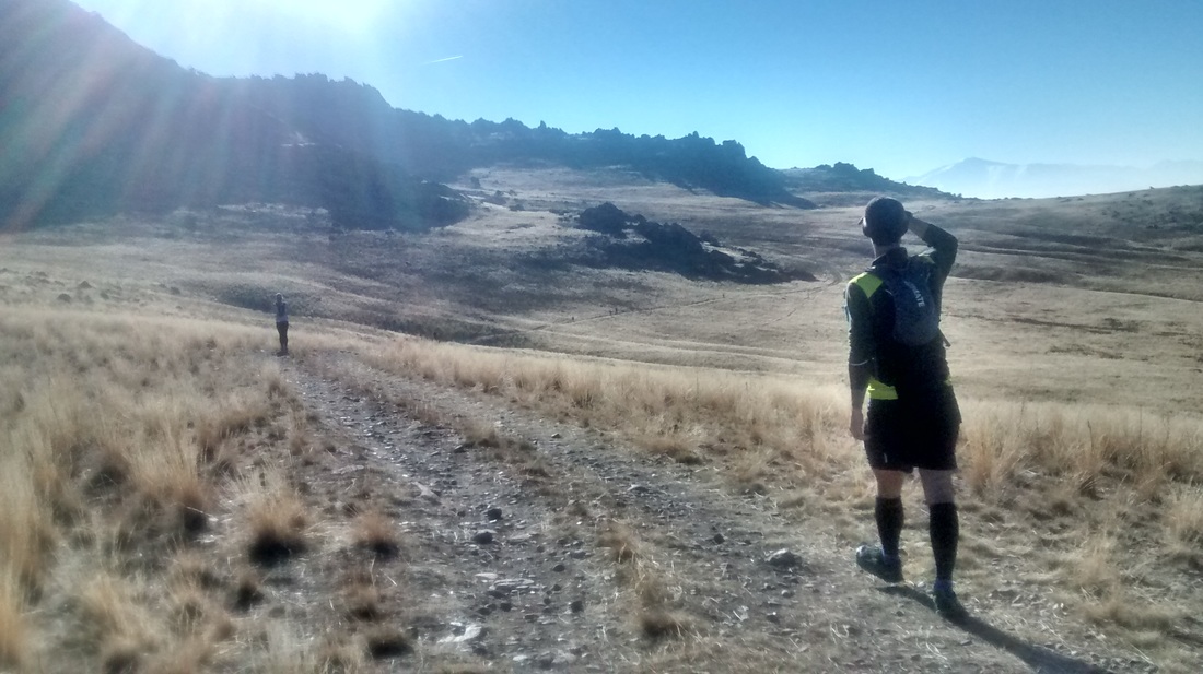
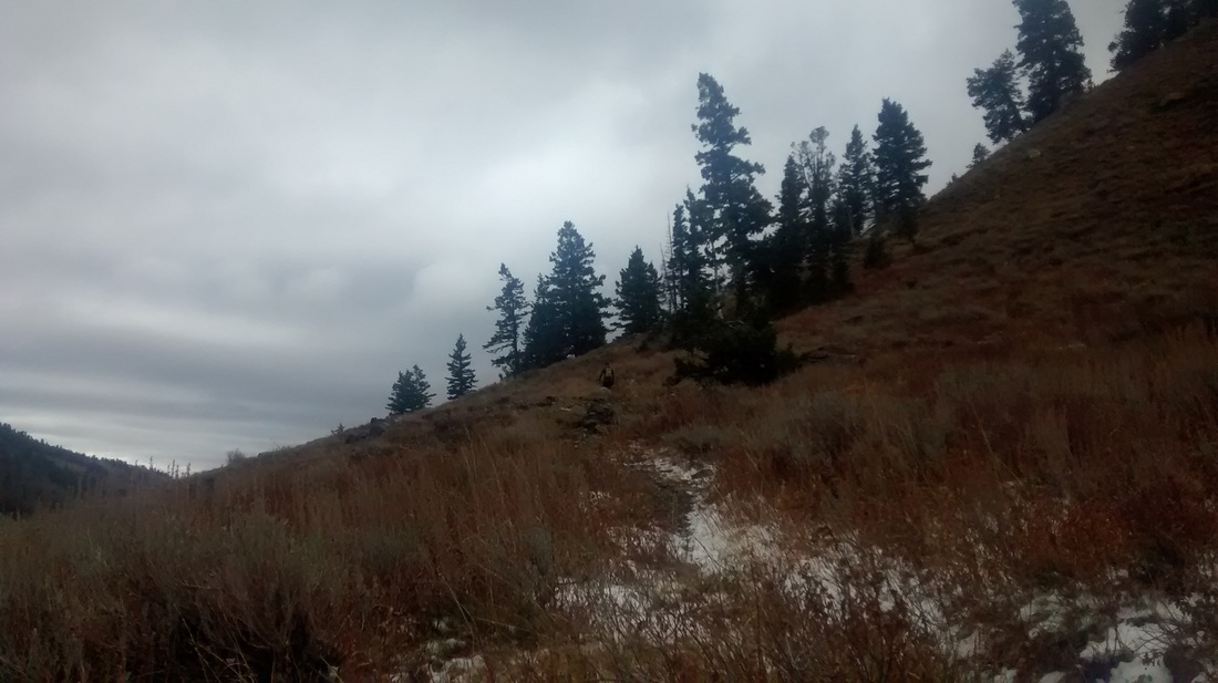
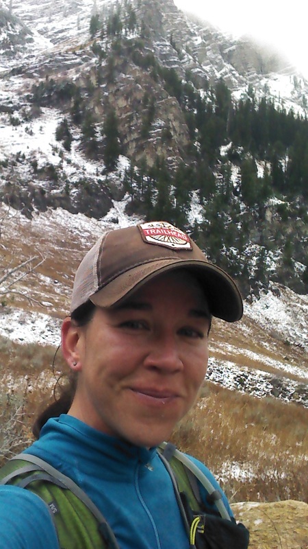
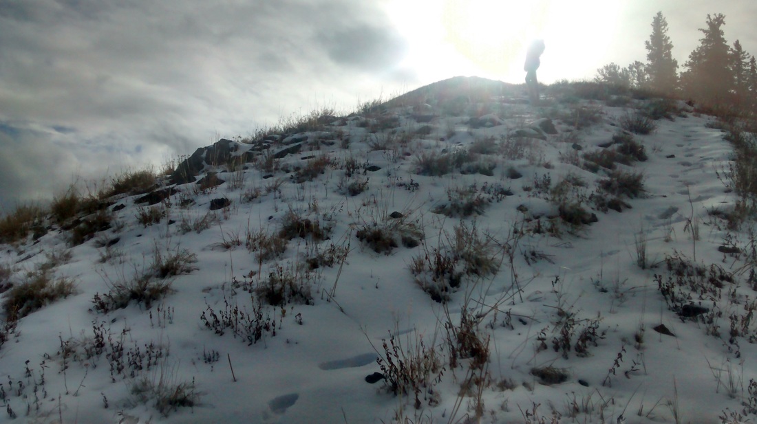
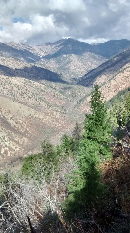
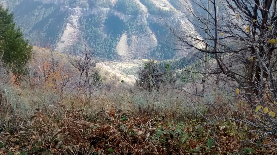
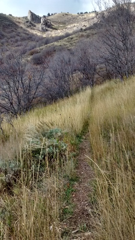
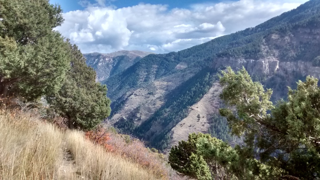
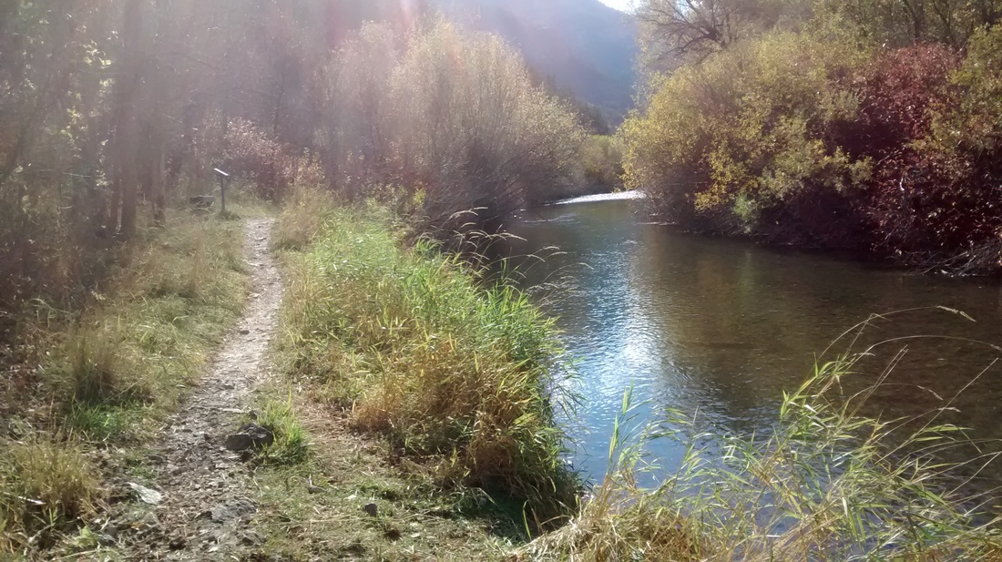
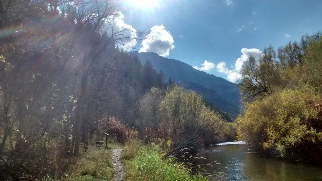
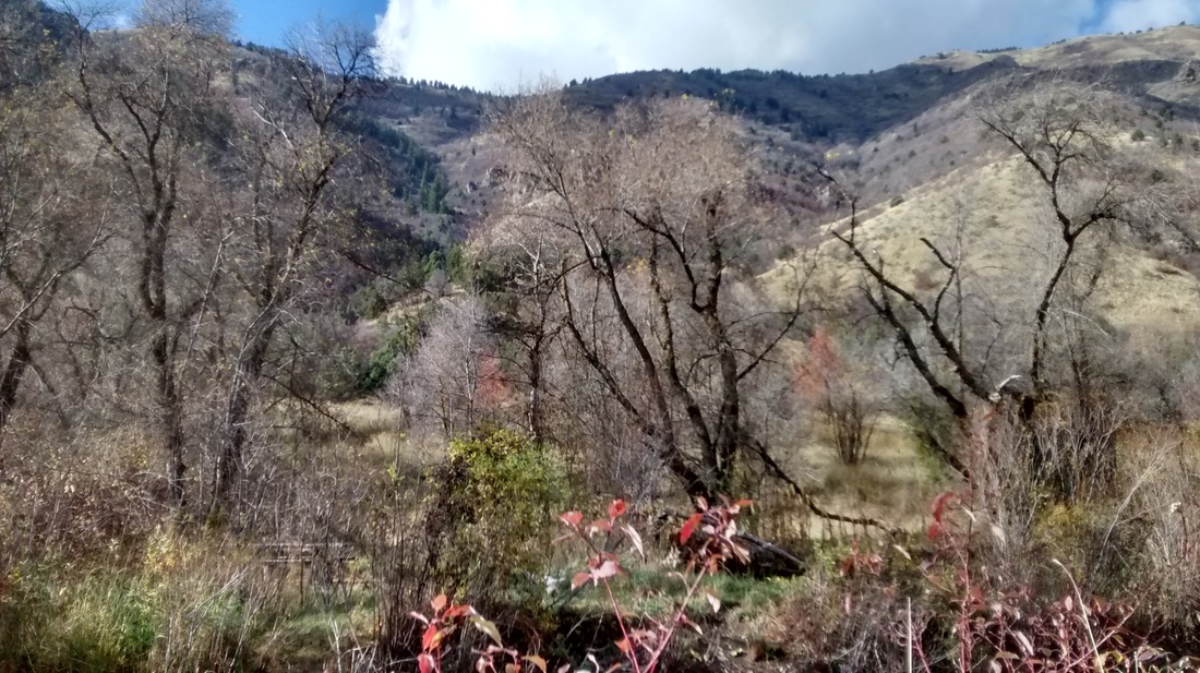
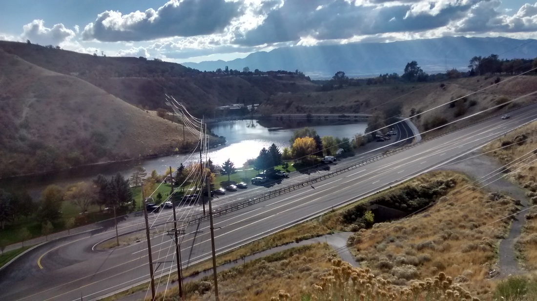
This trail adventure report is a bit different from all of my previous write ups. Here, I want to document my first effort as crew and pacer for a Bear 100 entrant and my new friend, Sam. We were put in touch by an old friend and colleague and interacted a bit over the phone and facebook in the months leading up to the race. Sam arrived the Sunday prior to The Bear to acclimate as well as get to know the area, and of course, one of her pacers (me). We hit it off without a hitch and spent the week exploring sections of the course as well as eating good grub and eyeing the ominous weather forecast for the quickly approaching race weekend. We spent our first full day together touring the Leathum Hollow AS location (the first spot where crew would be able to see her), as well as driving up and over from the Left Hand Fork of Blacksmith Fork Canyon to Right Hand Fork (where we would also be able to see the Cowly and Right Hand Fork AS locations). This plan was derailed when we ran into a road block with two unmarked officers. After approaching them to inquire as to whether or not we could continue, we were informed of an active crime investigation. We would later find out that there had been an officer involved shooting further down the road. We turned around and backtracked to the turn off for Temple Fork, which actually took us along the same paths as the runners until the turn off for the top of Ricks. The sun was setting and colors were amazing, however, we were on a mission to see what we could see as well as take a short run upon arriving to the Spawn Creek Trail Head (also the location of an aid station for the second half of the race). Fast forward to Thursday morning when John, Sam's other pacer and friend from her neck of the woods arrived. We ate breakfast and made our way up to see the Right Hand Fork AS, Temple Fork, Spawn Creek, and lastly Tony Grove - all locations new to John that he would be maneuvering likely after dark during my leg of pacing Sam.
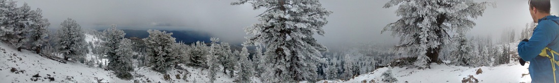
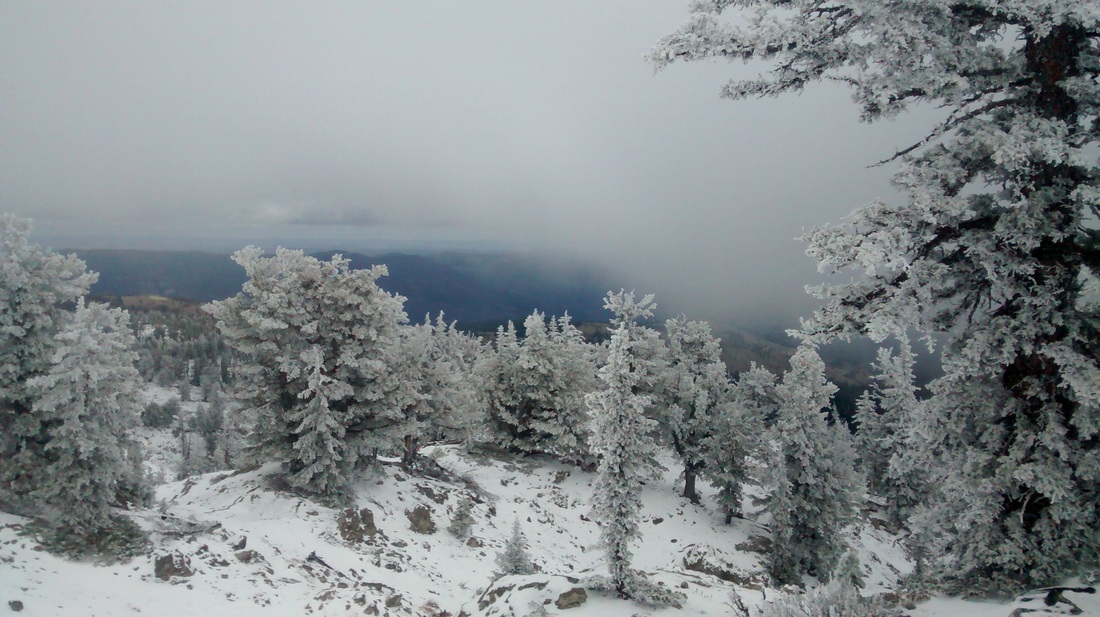
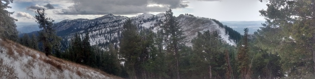
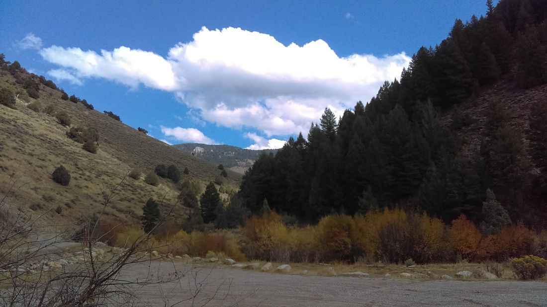
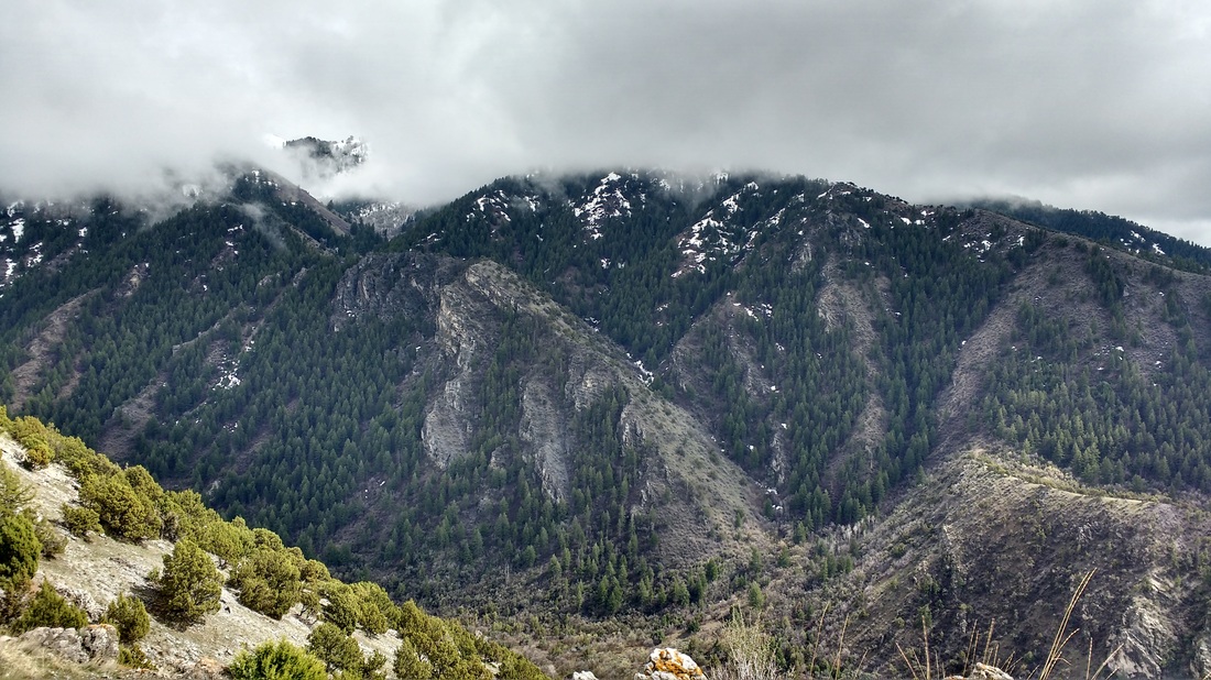
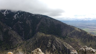
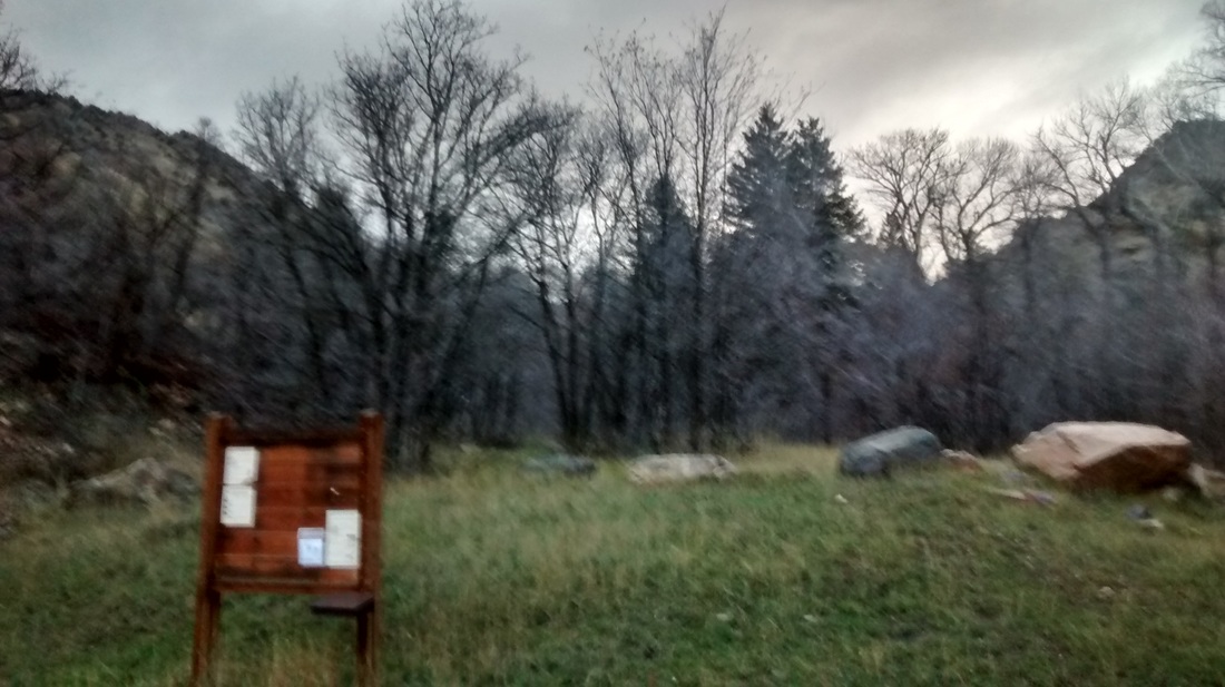
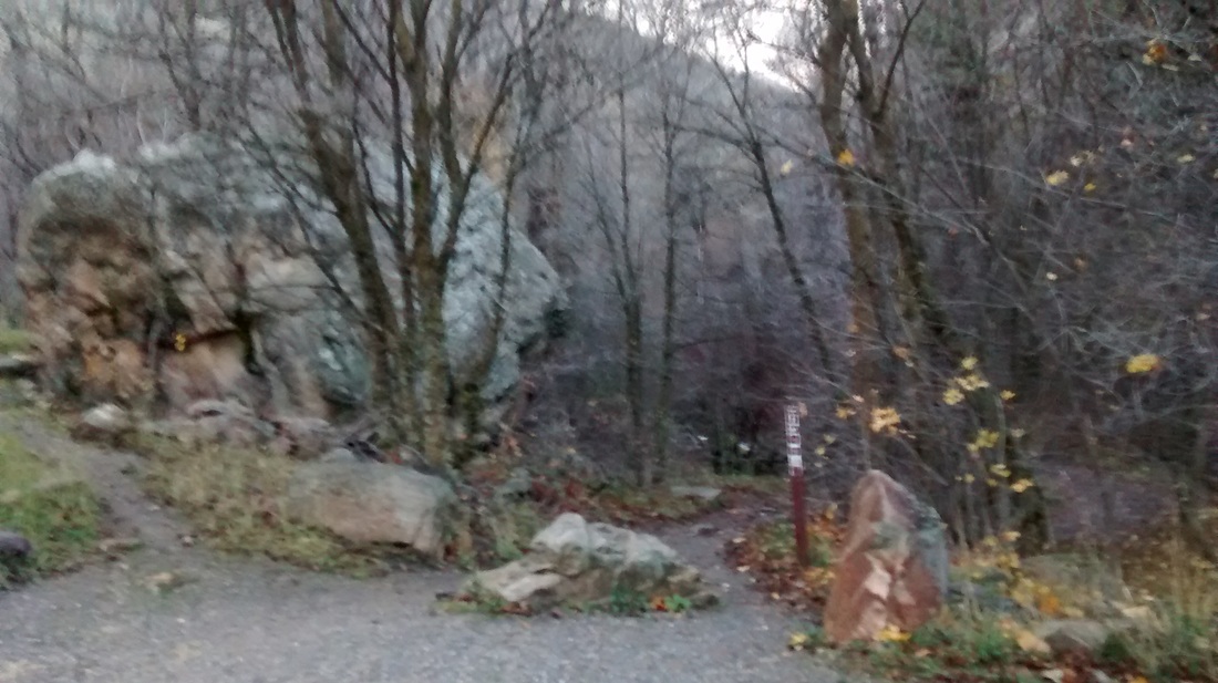
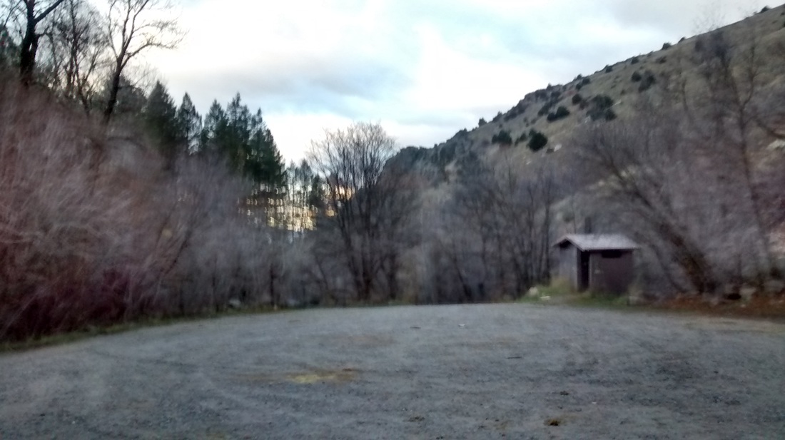
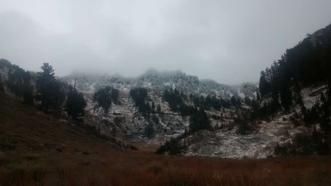
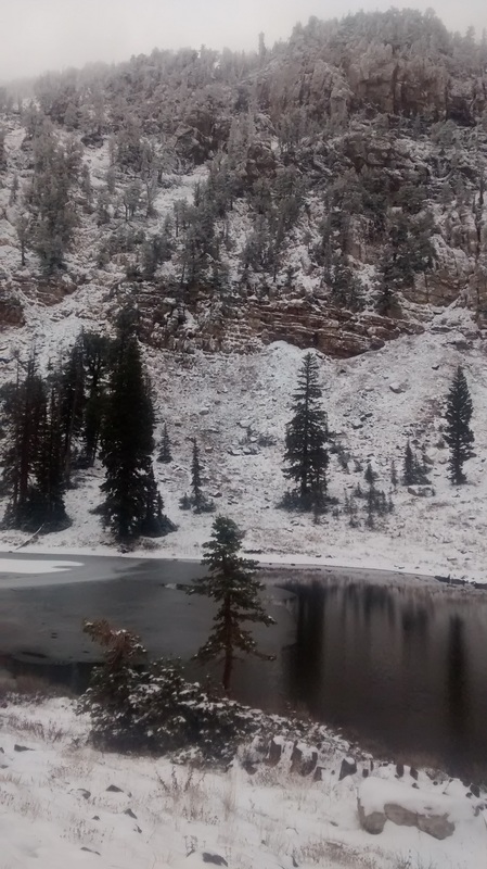
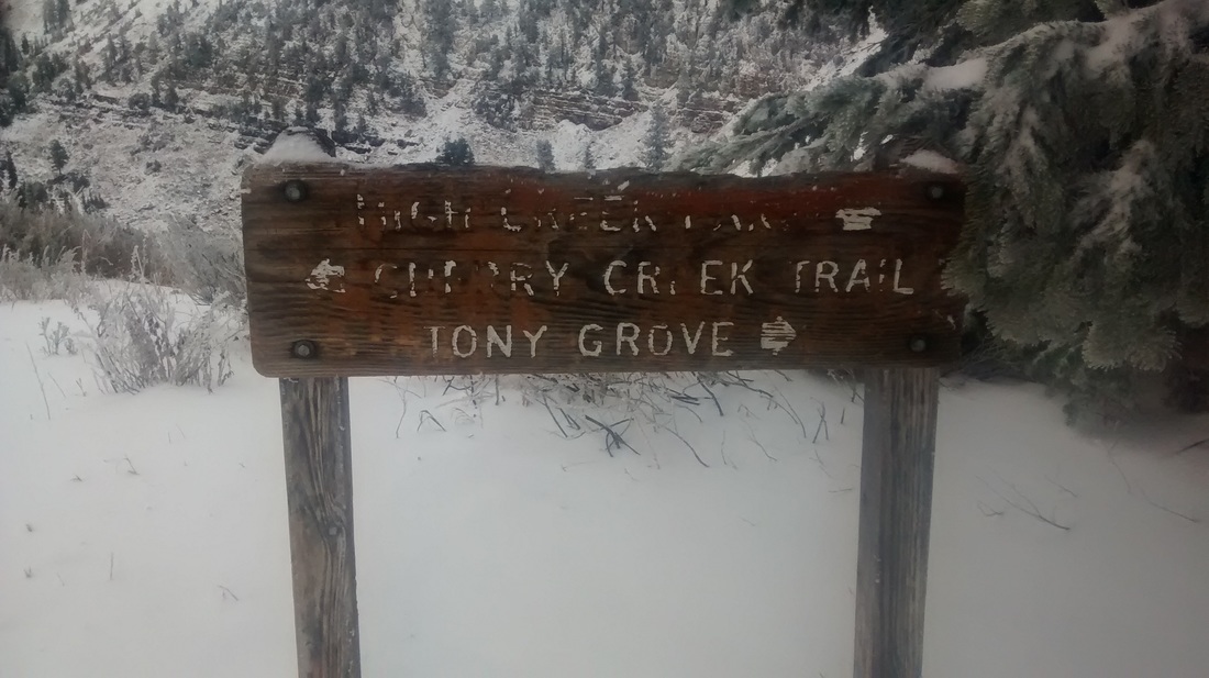
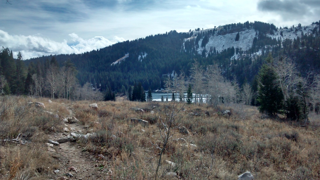
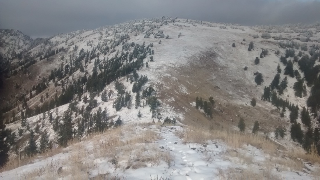
Here, we were scouting out the location of the Temple Fork AS (above). 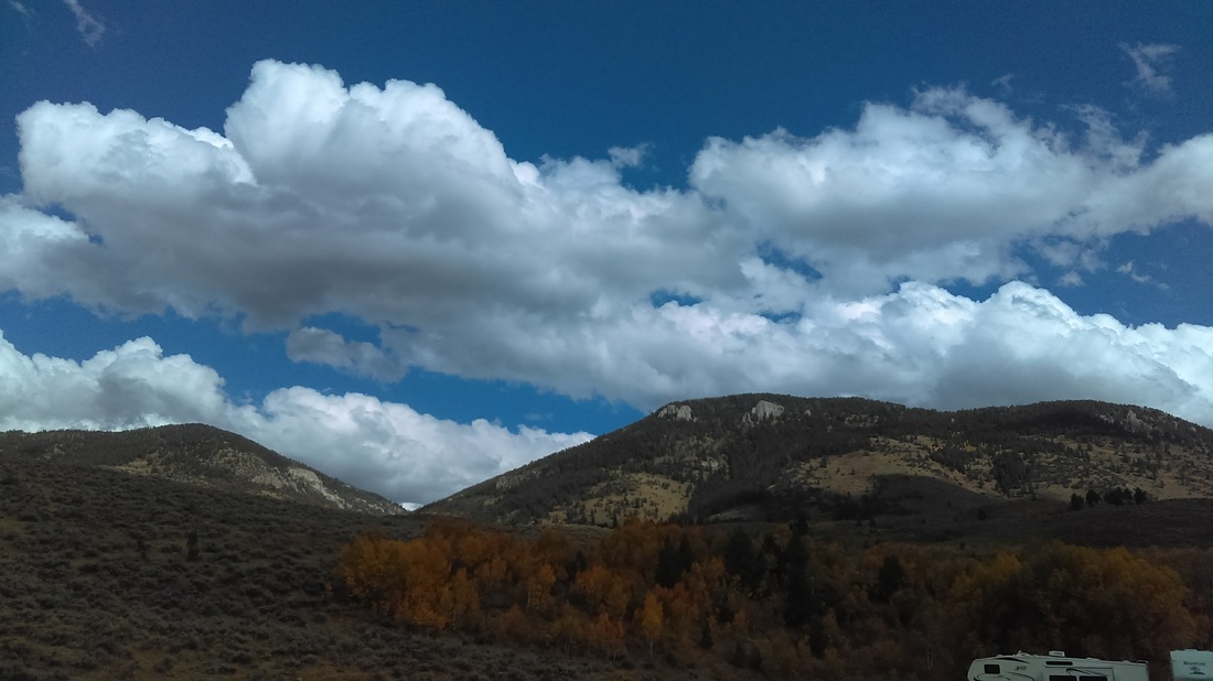 Scouting the location of the Spawn Creek AS (above). 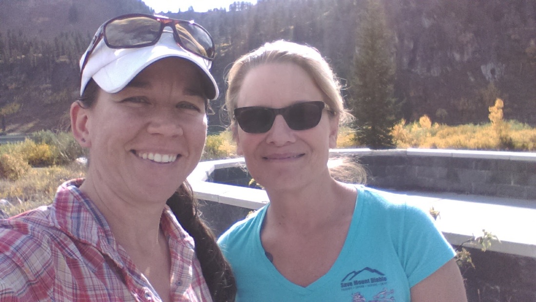 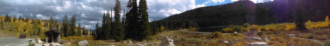 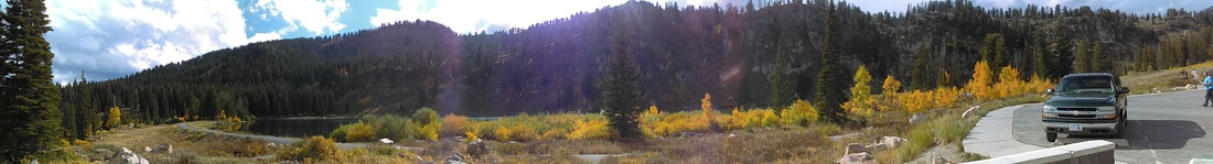 Taking in the lovely views at Tony Grove Lake, near the midway AS (soon to be much different conditions) (three photos above)
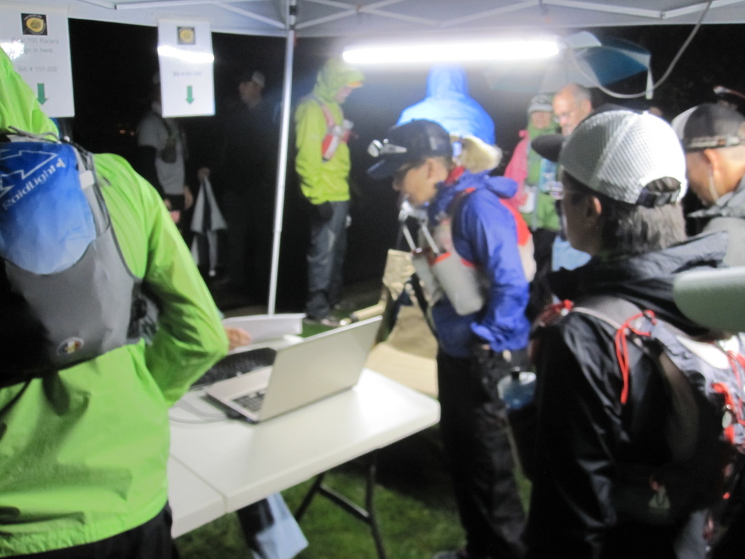
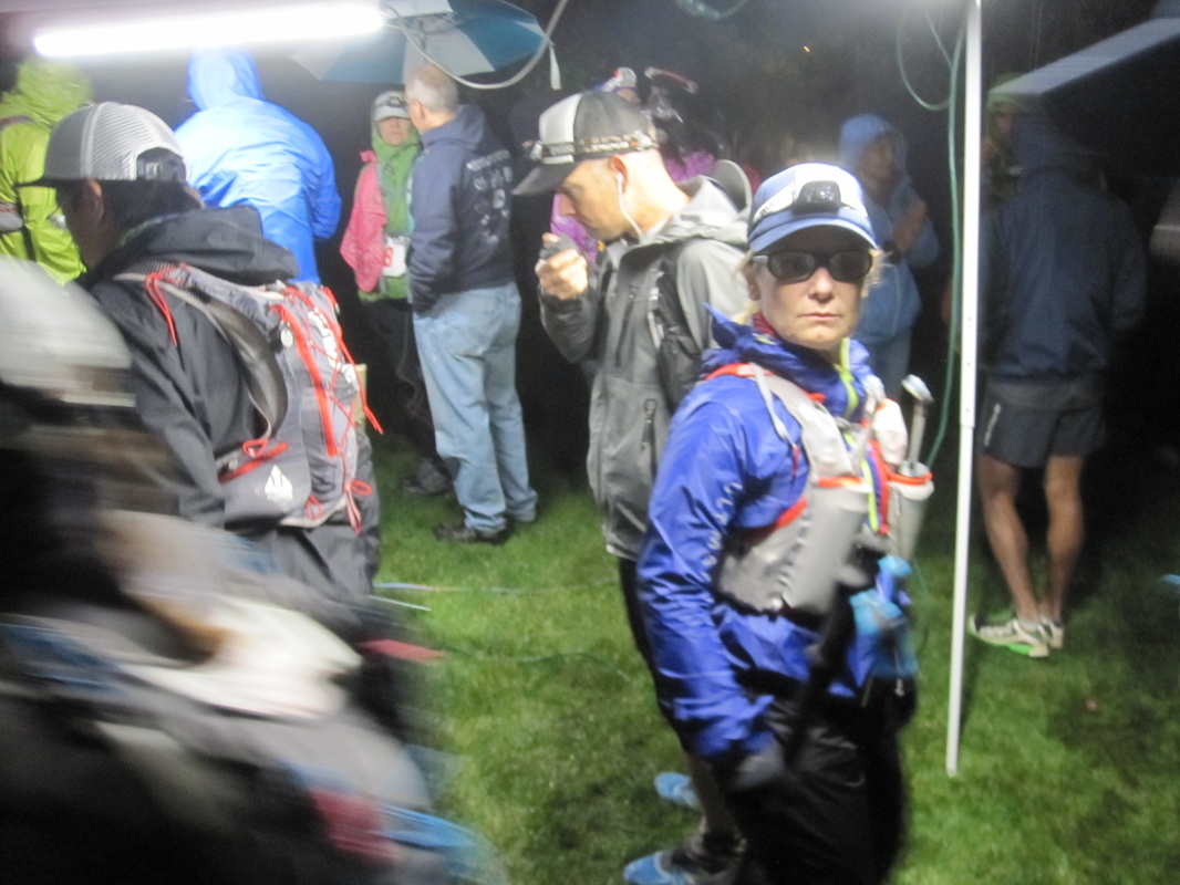
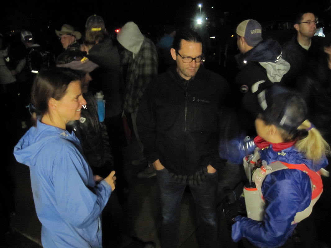
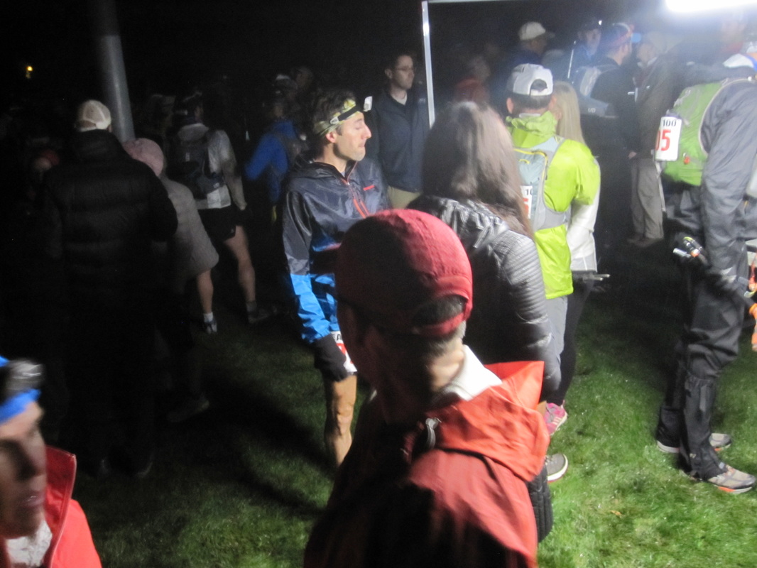
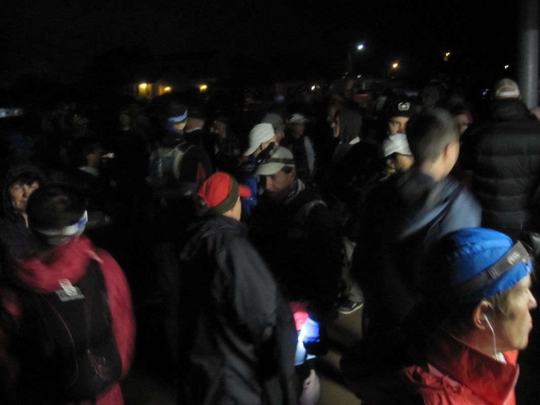
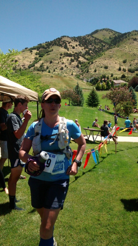
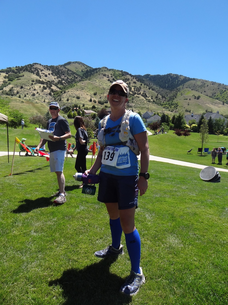
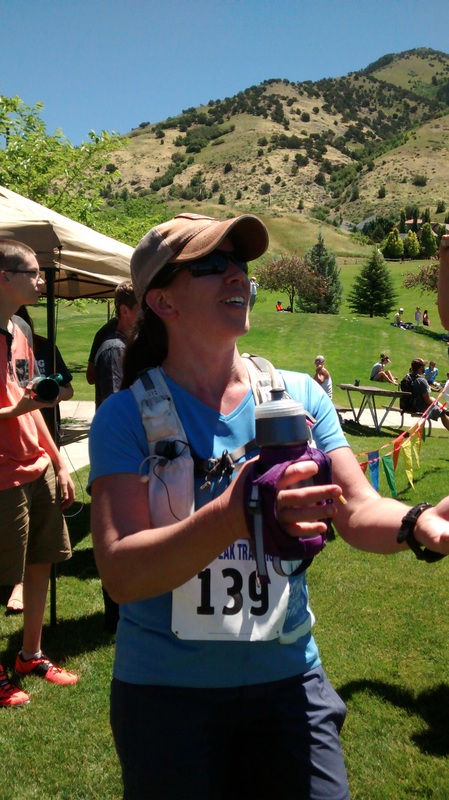
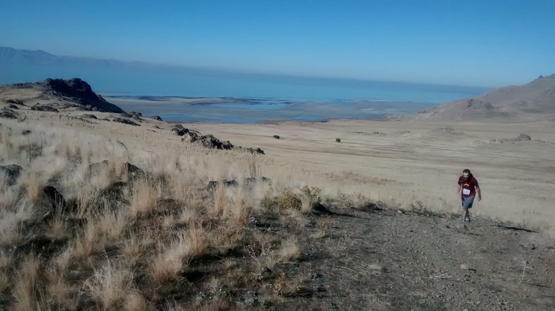
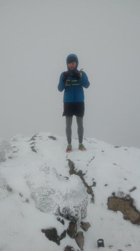
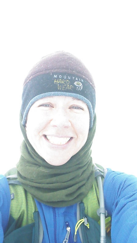
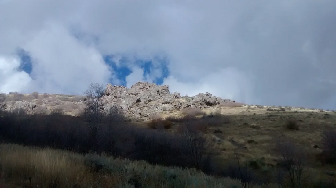
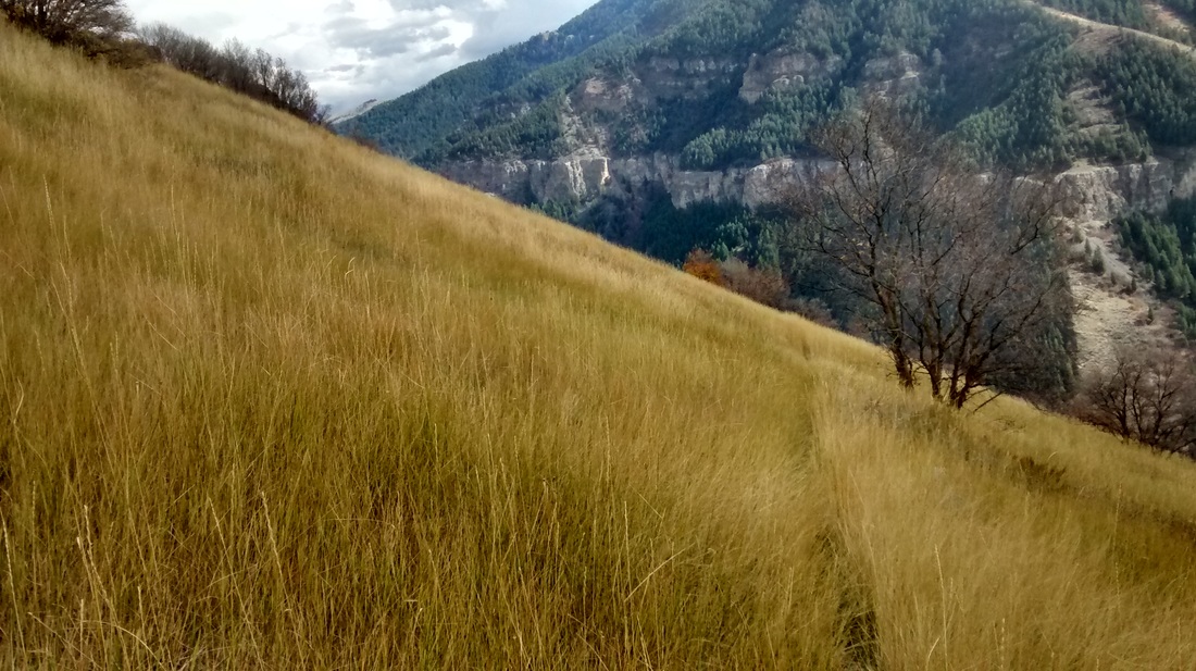
After much training and the final week of waiting, here were are at the 2016 Bear 100 start. Sam seemed calm, collected, and ready to embark on the adventure. The impending weather, course changes, and last minute needs didn't seem to cause her much visible anxiety. She checked in and we visited briefly with some local friends who had also hosted three Bear 100 runners. Looking around, I was proud and amazed by this mob of athletes and the journey ahead of them. Many were familiar with the area and/or the course specifically, however, it was a new day and conditions would be different. Short video capturing the Bear 100 start (above). Slide show of my 2016 Bear 100 photos (above). We arrived at the Tony Grove AS about 10 minutes or so after the 1:00 AM cutoff and it was time to withdraw from the race officially and retreat to the car, amidst the blizzard conditions. You would think our adventure stopped there, however, due to poor planning on my part the car may or may not have had enough gas to get us back down canyon to Logan. Luckily, Logan has some amazing folks and I happen to be friends with a number of them. Thanks to Stan, one of the ham radio operators at the Spawn Creek AS, for so graciously loaning me his rig to haul Sam and John home and pick up gas for my rig. Thanks also, to Stan's partner on the ham radios, who went out of his way to even fill my rig once I had returned with a tank of gas. Such kind folks, despite the weather and the late hour. What an adventure! 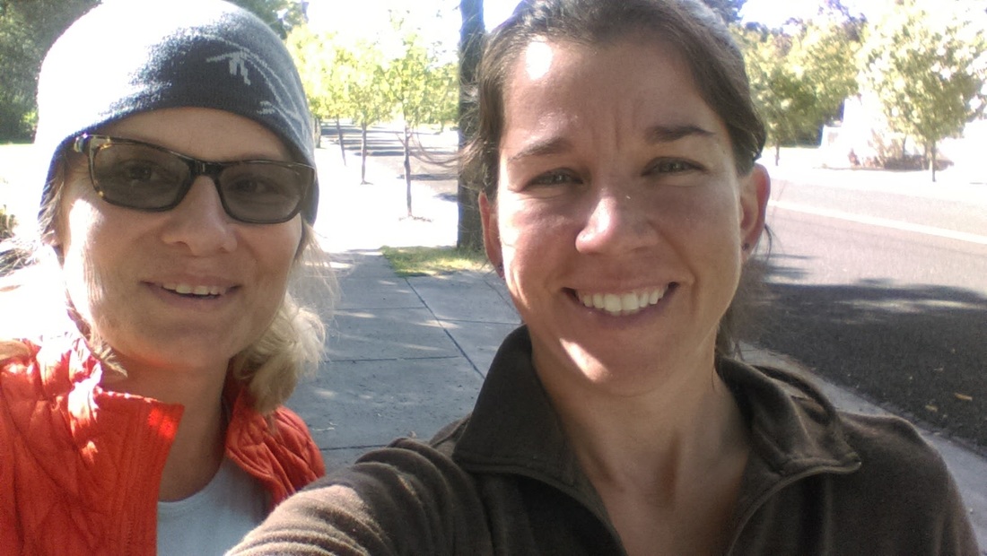 Sam and I, parting ways, until the adventure!
0 Comments
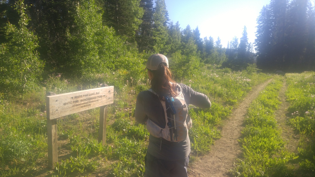
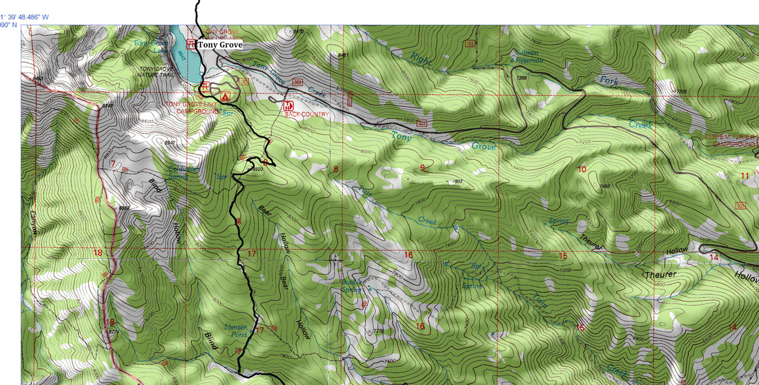
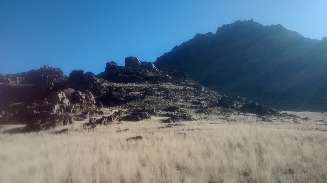
 It was a perfectly gorgeous and cool morning to set out for a 24 ish mile section of The Bear 100 course, aside from this darn lingering cold. Rob and I met at a little after 6:00 AM at First Dam to drive up to the Beaver Mountain Ski Resort to drop off my rig at our ending point. We spotted a cow and young moose as we departed the Ski Resort parking area. We then headed back down canyon and up to Tony Grove to get started on our adventure. After a quick pre-adventure photo opportunity, we started on trail by 7:30 AM. This would be our only familiar stretch of trail until we reached the trail junction where you can go left to White Pine Lake or go right and follow White Pine Creek to the east through the valley floor. This, in my opinion, was the most gorgeous part of this leg of the course.
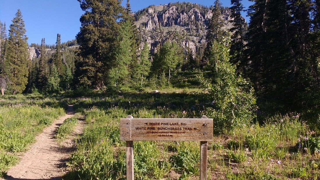
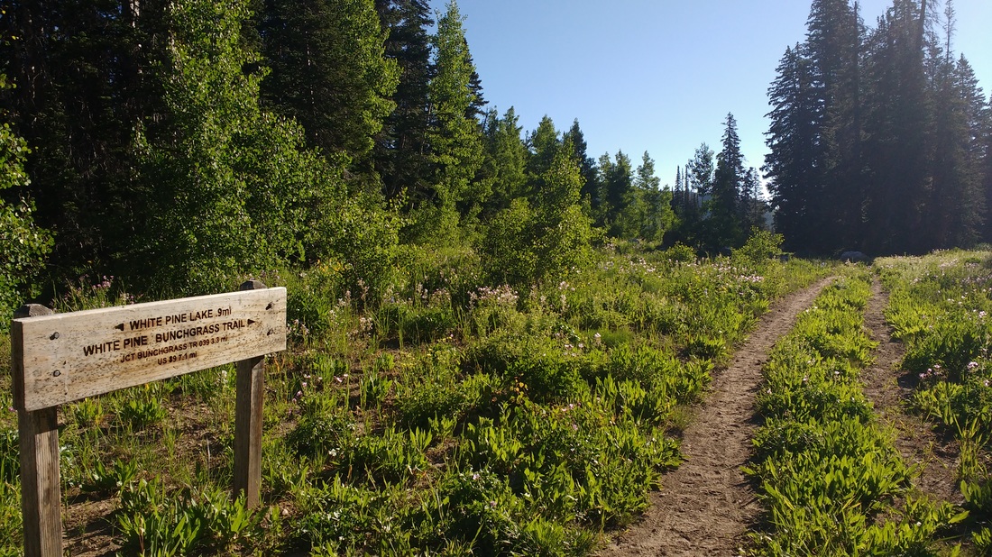
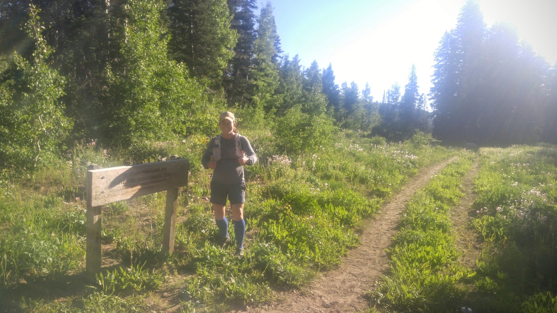
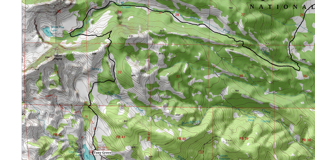
Photo cred to Rob for the two above 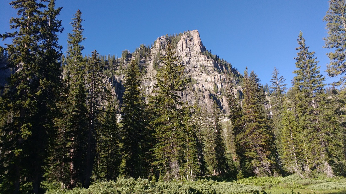 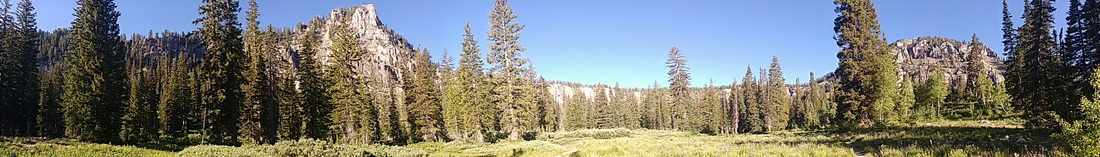 The photos above are looking toward White Pine Lake from the trail junction and sign. 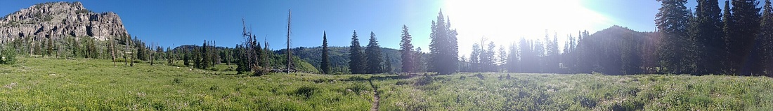 Running along the valley surrounding White Pine Creek was amazing. The trail was mostly mellow single track, and generally downhill with a few rocky sections. There were a few bike tracks from some recent mountain bikers along the path.
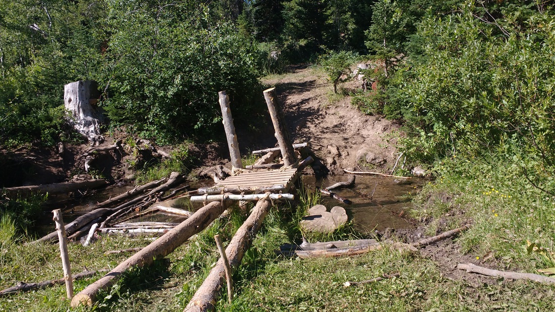
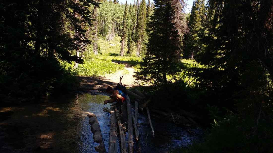
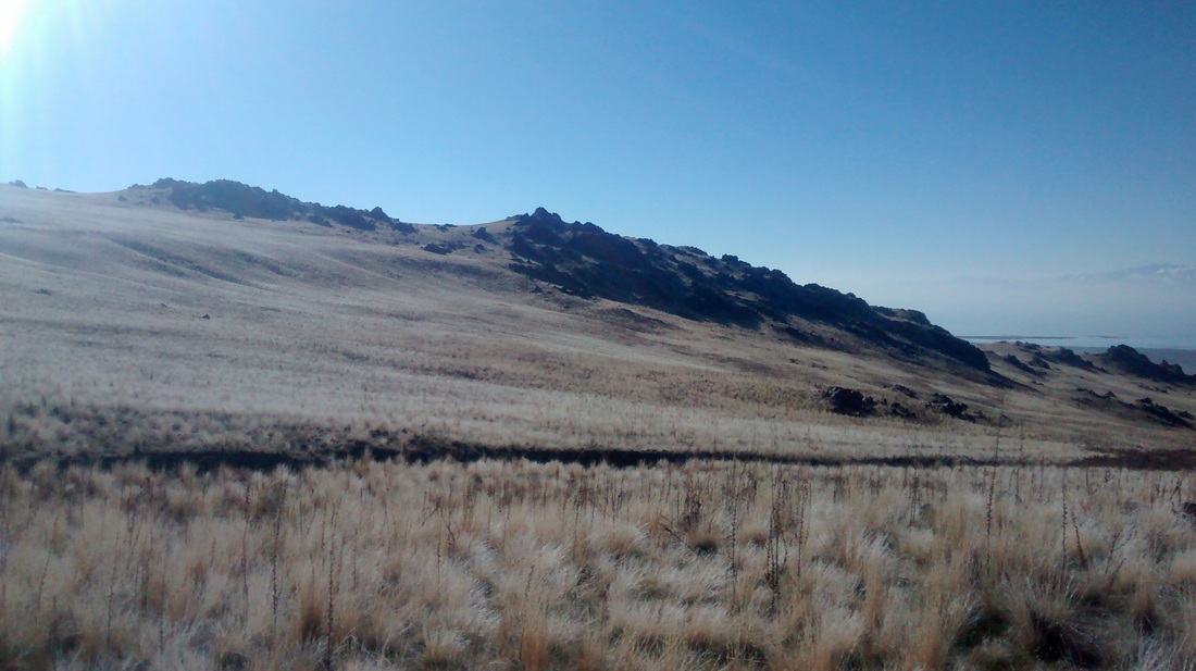
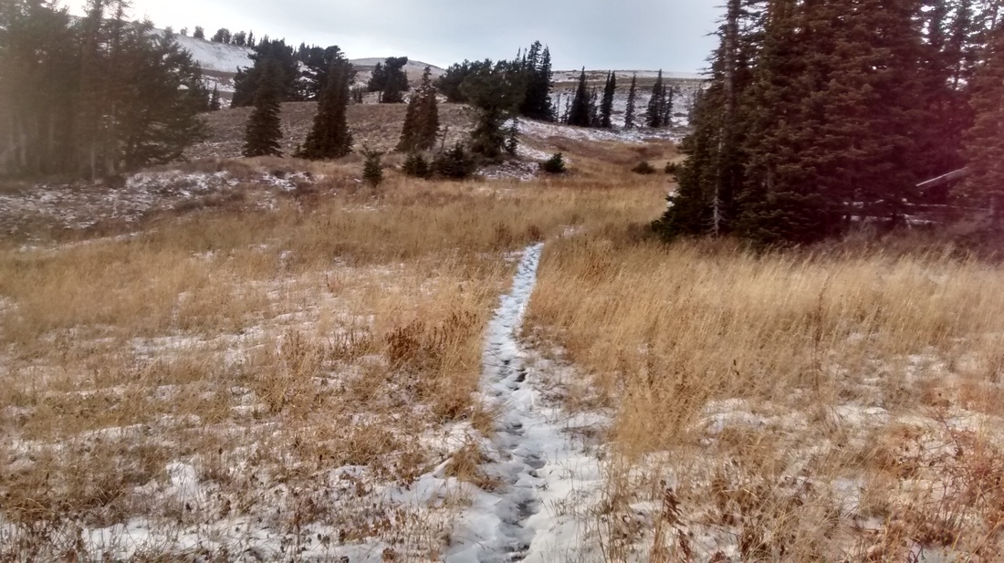
This trail split (pictured above) is roughly 3 miles from the last trail junction, back near White Pine Lake. The trail along this section had a fair amount of loose cobble as well as vegetative cover. We tried to envision how tough this would be after almost 60 miles of running and took a mental note of it (for future pacing duty). 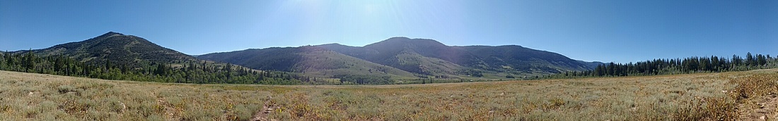 The photo above is one of the fields of Mules Ear (noted in the step-wise course directions) just before reaching the Beaver Pond and plank bridge shown below.
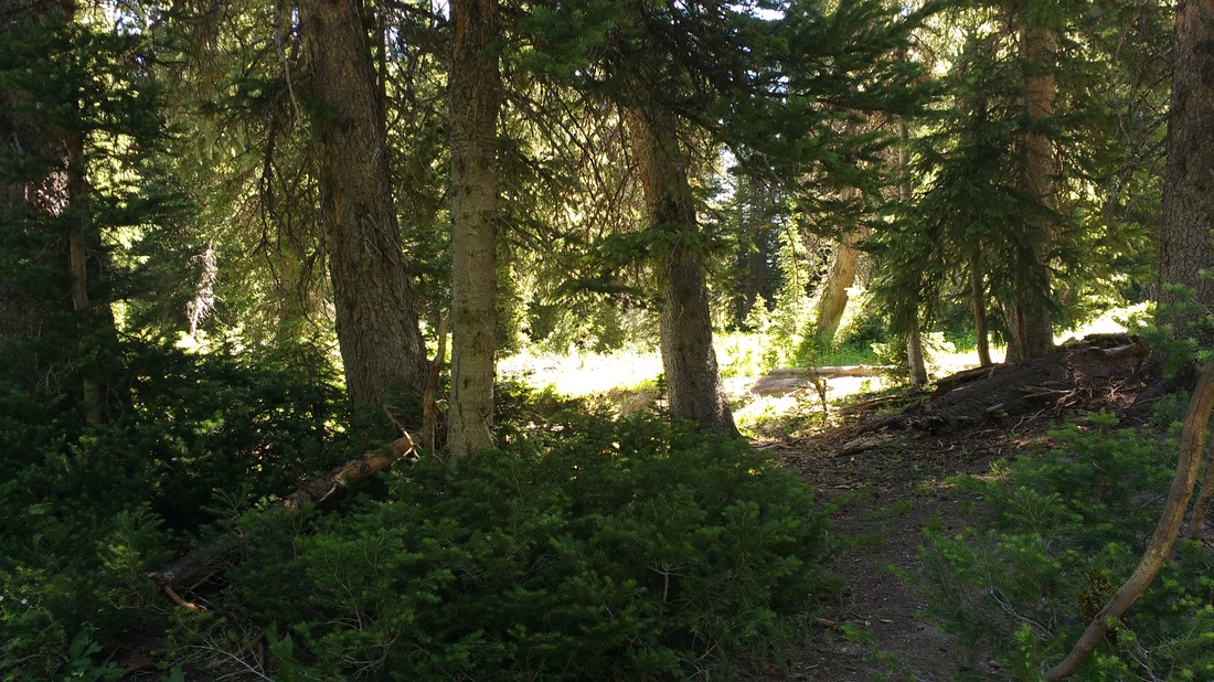
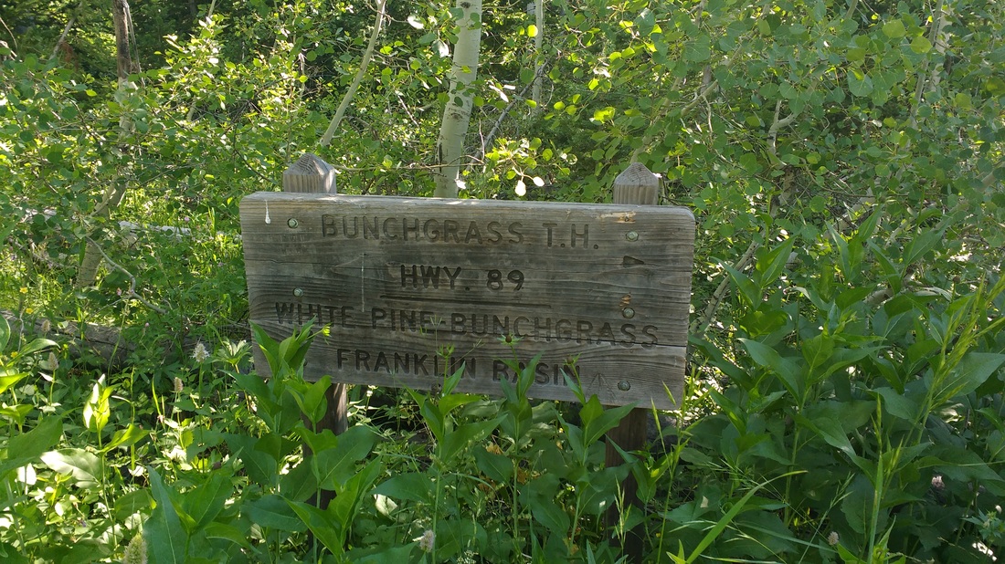
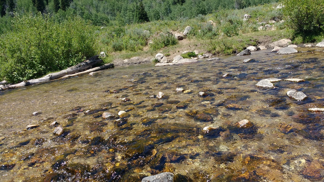
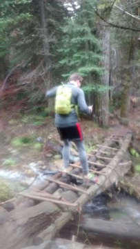
We continued up the two track, as opposed to running to the actual location of the Franklin Basin aid station, as well as said hello to a number of campers set up along the road. We reached a dead end (circle) and picked up the most obvious path through the conifers. There are a number of paths (cattle) in this area so we just continued on what seemed like the correct bearing. We climbed the Steam Mill trail to eventually reach the next Creek Crossing (pictured below).
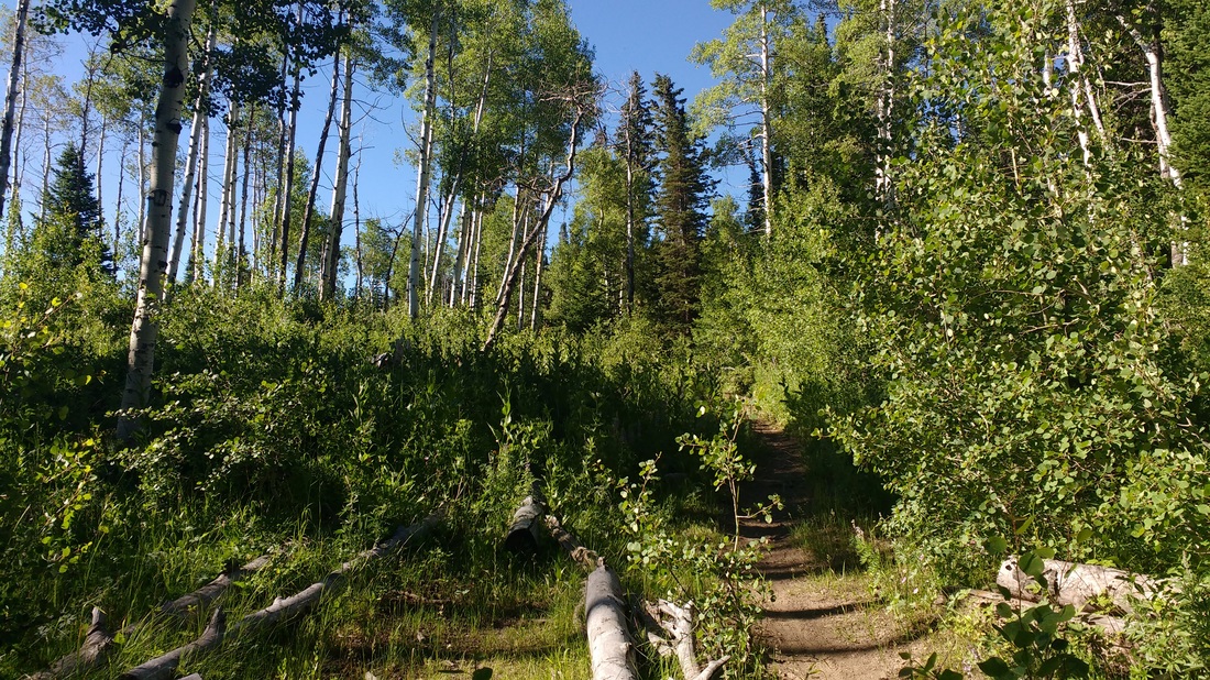
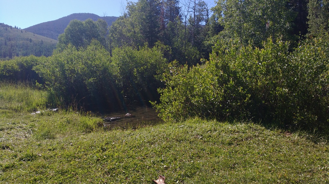
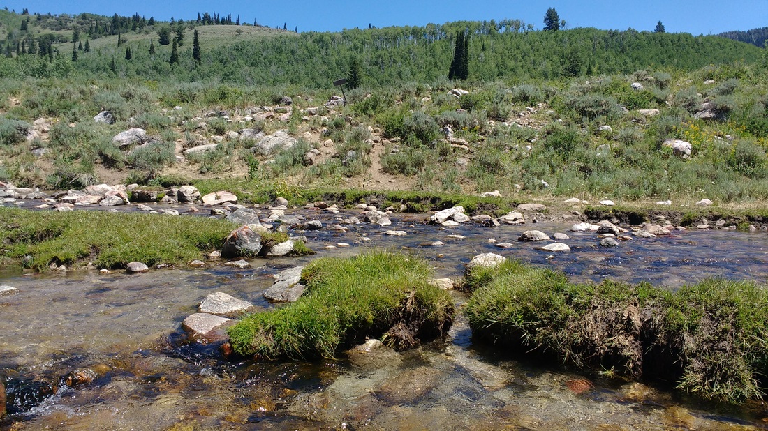
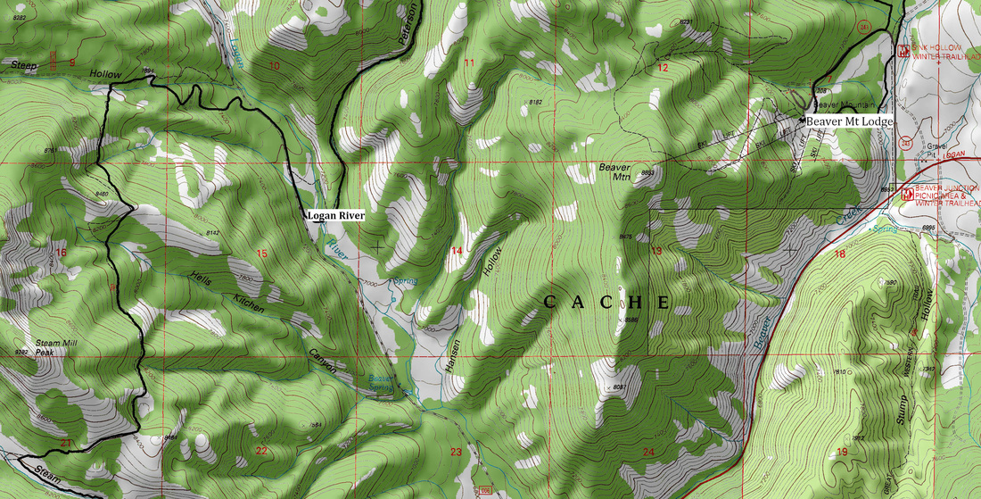
 The step-wise instructions advised that we would cross to the north of the somewhat shortly before our next trail junction AND that if you cross back over the stream from right to left and see an old rusty steam mill boiler, you have gone to far. We luckily, didn't make that mistake however in hindsight, I kind of would have liked to have seen it. Ah well, perhaps on my next casual stroll up there. We were keeping an eye on the 3.6 mile mark from the last aid station, as this is where an unmarked trail would be. Luckily, for us the Shorty's Cut Off trail had a nice sign. We continued on to Shorty's toward the Logan River/Steep Hollow Aid station. 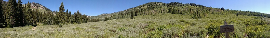 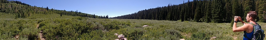 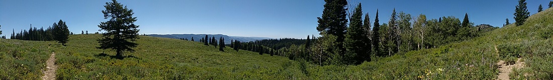 The views along Shorty's did not disappoint. We did, however, miss a turn or took a wrong turn before reaching Steep Hollow Road. We knew were were off track, but felt confident enough that we'd hit Franklin Basin road soon enough that we didn't turn around and back track. We did, eventually, reach Franklin Basin Road. Luckily, from the actual aid station, you have to run down Franklin Basin Road about 0.6 mi to get to the Logan River Crossing and access the Peterson Hollow trail. As a result, we weren't too terribly far from our next destination.
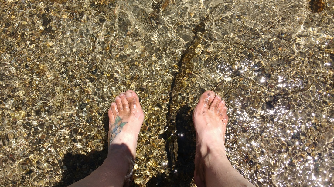
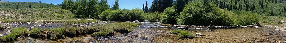 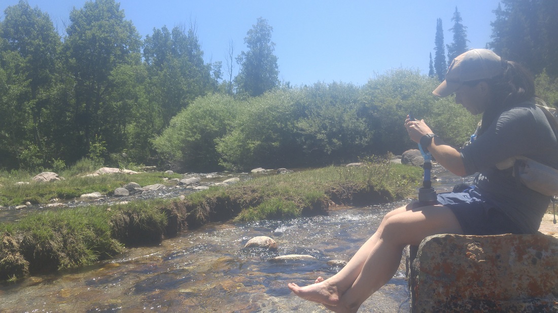 Photo cred to Rob for the photo above. After a little bit of back tracking up Franklin Basin Road, we reached the two track that led down to Logan River where we would cross to access Peterson Hollow. This was a welcome break as the day was heating up and we were happy to restock on ice cold mountain water as well as soak our hot and dirty feet. I'd say this time of year, you are pretty much guaranteed to get your feet wet at this crossing.
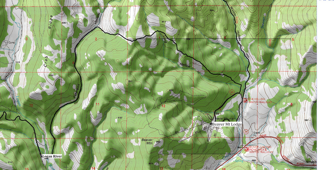
 After our river recharge, we power hiked up Peterson Hollow. The trees tightened around us providing a somewhat eerie effect. Signs of cattle were evident the entire way up, but we didn't see them until we reached the turn off for Long Hollow. There was a cairn as well as flagging at the turn off, however, we had also seen flagging down Hell's Kitchen Canyon, so I might have been skeptical.   After a bit of running, we seemed to be 100 percent on track as we followed along the North side of Long Hollow. We could finally see a few of the Beaver Mountain runs in the distance and felt our adventure coming to an end (as well as Bear Lake raspberry shakes on our horizon). We descended down a rocky path, as the direction specified, but definitely missed the cutoff trail and ended up out on Beaver Creek Road. We cut back through the woods to get on the main paved road to Beaver Mountain and looped back around the the car. What a day! Thanks to Rob, for the company and tolerating my hacking the entire way. Stupid cold. Unfortunately, we failed to capture an after picture. I will tell you, I had a delicious raspberry shake, coke, and the most amazing corn dog ever. Rob settled with a raspberry shake and Mountain Dew. (To clarify, I actually ate the "extra shake" provided in a small cup and took the larger shake home to the littles. Everyone was happy. Winning.) Click here for course directions Here are the course maps for this section of the Bear: Shoes: Hoka One One Challenger ATR
Pack: Nathan Vapor Shape Sustenance: Tailwind (started the run with 300 calories worth in my handheld, 1 Kind Bar, Hammer Gel in a soft "GU Brand" reusable bottle, 3 electrolyte capsules. I also started with 2L of water in my pack and refilled my handheld water bottle at our Logan River crossing. Water filtration: Sawyer Mini Water Filtration System 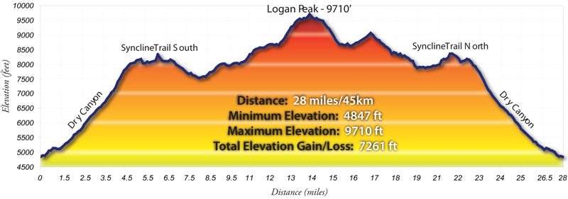
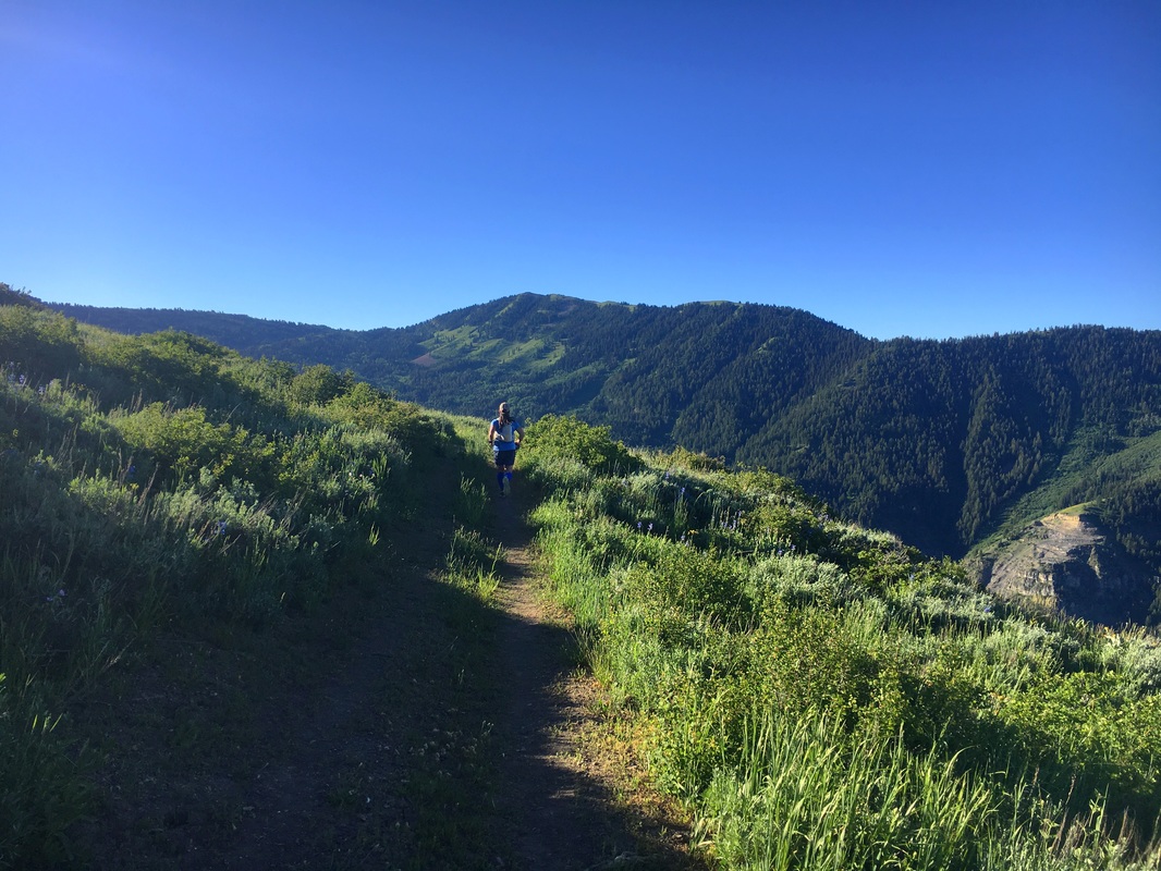
I arrived at the start around 5:30-ish and made my way over to check in. I visited with Diane and Shannon as well as getting a “before picture” (thanks again for that, Shannon). Start time was closing in, and this was one of the few times I wasn’t anxious at all about getting started (I usually get a bit anxious before long runs, whether races or self-supported). Perhaps it was a combination of the friendly and familiar faces at the start as well as kind of feeling less prepared than I had a month ago. That may seem backwards, but feeling unprepared, I was just in it to finish and didn’t have any other big goals in mind. When asked if I had a goal, I just went off my last 50K time and added on….maybe 7 hours? I don’t have a strong track record for estimating the time it will take me to do trail runs. Usually, I grossly underestimate the time. For this one, I actually overestimated - hey, I will take it! 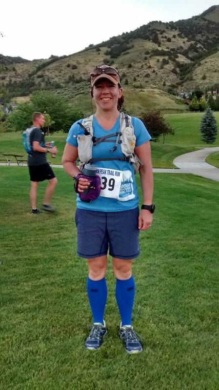 Apparently, this is my blue period, for trail attire. Thanks to Shannon for the before picture (above). The race got started of course right into climbing, first out of the park, through the bench neighborhood, and then along the Bonneville Shoreline trail over to the mouth of Dry. I had trained quite a bit for the start and for the climb up dry but between allergies, losing old dog family members this Spring, and the busy nature of life, I had definitely slacked off in the final month or so before the race. I alternated between jogging and power hiking up Dry, as when I fail to find my groove with the uphill jog, I can usually power hike faster while keeping my heart rate low. I followed close behind a few folks who had settled into a similar pace and was passed by a female with an amazing powerhike. I marveled at her extra long and smooth strides. I am pretty sure I met her at the last Logan Peak and she was recovering from a broken hip or something similar (or it was her doppelganger). Either way, impressive. I cruised through the first aid station as I am an “everything but the kitchen sink” sort of packer and definitely needed to eat/drink off some of this extra pack weight. It was fantastic to run with Tara along the South Syncline as well as off and on for the rest of the race. I had run part of the S. Syncline in the past, but it was always under a bit of snow so for this effort, it felt like a new trail. It certainly did not disappoint! The wildflowers and ridge views were breathtaking and the break from the uphill climb was perfectly timed. 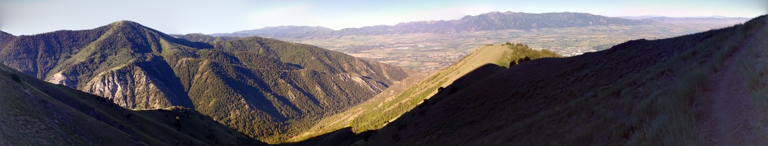  Photo above - Tara coming around the bend, along the South Syncline Trail
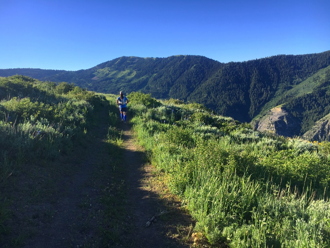
Thanks to Tara M for capturing a few photos of me (above) heading down the South Syncline trail. Eventually, the single track became more of a two track, and the ups and downs turned to more consistently up. Being familiar with a portion of the rocky road just above the Providence Canyon quarry, I had expected Welch’s Flat road to be much worse (like ankle breaker worse). It actually was quite nice for the most part. The road wound around and for a moment we could see the Logan Peak tower in the distance. This was the stretch of the course that I had not ever been on, so I assumed the peak was roughly half way. Within the last mile before the second aid station, my quads started to cramp up. I took two salt tablets and mentally crossed my fingers that the aid station would have bananas. That combination often resolves cramping for me if addressed quickly. The salt seemed to help immediately. Along this stretch, I also had the opportunity to meet (for the first time in person) the smiley and speedy, Lee L!  Arriving at the second aid station, I grabbed a couple bananas, potato chips, and topped off my water bottle. I passed along my thanks to another awesome set of volunteers and continued up toward the peak. This stretch of road may be the most deceiving as the tower appears to be so close, however, there are some nice long switchbacks before arriving at the summit. It was fun to exchange encouragement with those who had already summited and were on their way down. They all looked refreshed and enjoying the downhill. I was already looking forward to that. Along this stretch, I heard my name from a familiar voice as Lacey came up for a visit and then passed. I also saw Diane shortly after her summit along this stretch, looking strong and making her way back down the big switchbacks. I think it absolutely made the race to share the start, the trail, the summit, and the finish with friends. I hit the shed up there, as I thought that was the official requirement and snapped off a couple pictures as well as admired the alluring ridge line that wondered off toward Providence Peak. 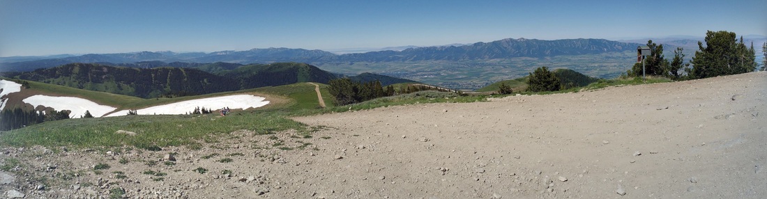 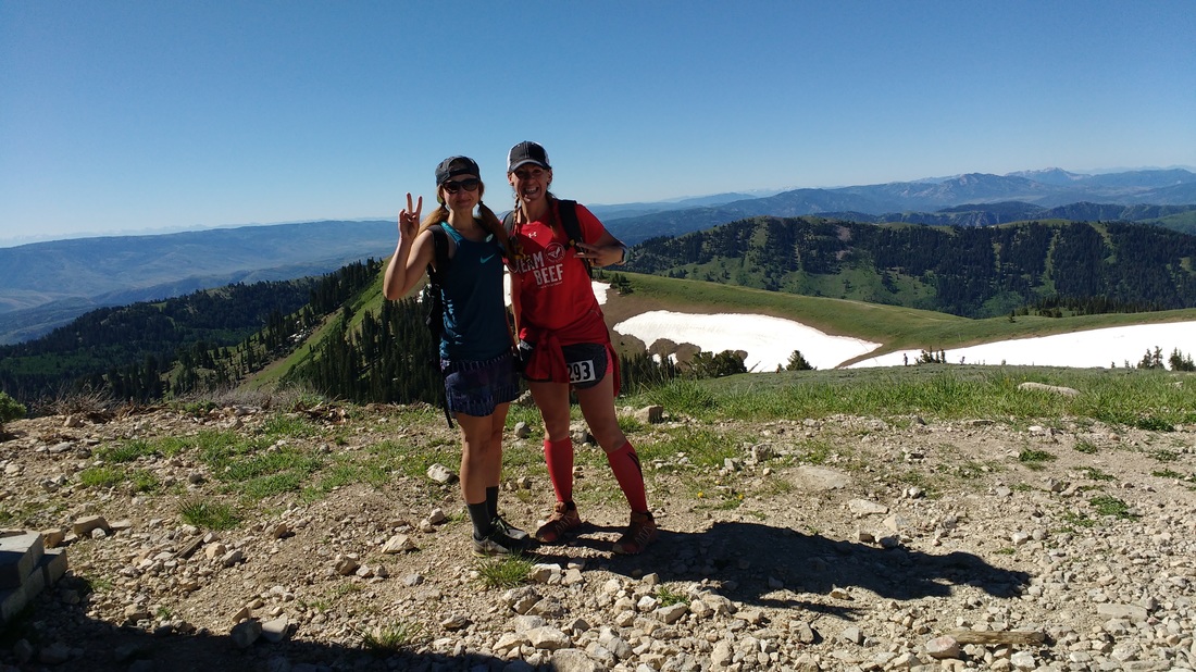 Tara and Lacey on the Logan Peak Summit, still smiling! It was time to change gears and settle in for a mostly downhill cruise. It took my legs a bit to figure out what I was asking of them, and soon enough I found myself back in the last aid station at the base of the Logan Peak road. I scarfed down a few more bananas, still trying to keep the leg cramps at bay, as well as potato chips and a small cup of coke. I like coke, but it doesn’t taste much better than during a long run. The subtle burn of the carbonation as well a little sugar kick felt great. It was now time to get back to the stretch of trail I was familiar with. I ran the road with a bit of familiarity as I had driven it before looking for this same two track last Summer. The difference was, of course, that I was in a car and it was about 11:30 at night. There was a short jaunt along the road, as well as the passing of some super cool motorized users as well as one asshat on a dirt bike who I had envisioned socking the first time he passed along the Peak road and gunned it spewing rocks at runners. My annoyance with him was immediately curbed by the lady who came by shortly after him on her dirt bike cheering every runner on with congratulations. Alas, I hit the two track. I cruised down this stretch feeling thankful to be back in familiar territory. Cow poo camp, looked lush and totally free of cattle and soon it was time to turn on to the North Syncline. This stretch is a nice combination of shorter ups and downs through duffy pine sections and then a few meadows blanketed with lovely wildflowers. I tried to keep Lacey's red shirt in sight as she seemed to glide through this section. Eventually, I lost sight of her. I knew there was another climb before hitting dry as I remembered this climb from last year’s Spring Hollow to Dry adventure. I also remember hitting it on tired legs and although it isn’t steep, I just was kind of out of juice for climbing at that point. I power hiked through the meadow while stopping only snap to a few photos.  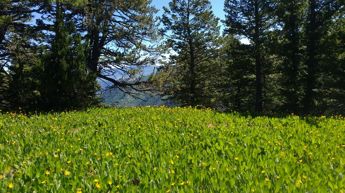 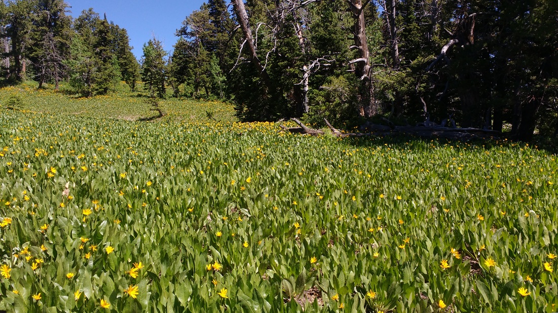 After getting up and out of the meadow, there is a stretch of trail that is probably my least favorite, before hitting the spring/water trough. Due to run off and erosion, is V shaped and just tough to run (whether on tired or fresh legs). I think knowing the trail well enough to know it is brief helped with my mind set. I got through that, cruised on past the spring, knowing I was fine on water and well on my way to the fourth and final aid station before my favorite part….trucking back down Dry Canyon. I stopped for another banana and the fine folks at the last aid station topped off my water as well as warning me about an elusive root smack dab in the middle of the aid station trail. I thanked those folks again, and started likely my best effort of the race. Although tired, my legs were still pretty responsive and seemed ok with maybe over-doing it on this downhill stretch. Perhaps, I over conserved earlier in the race or perhaps the downhill training I did in dry over the last few months was one of the few things that felt “old hat” to me. Either way, it felt amazing to pick up some speed and sail (for me anyways) down dry. Along the way, despite the legs still feeling great, I started to get a pretty intense side stitch. Deep breaths in and short fast and hard exhales seemed to work it out enough for me to continue my sprint down without doubling over. At one point, a leg cramp kicked in and my right leg seized mid stride. Luckily, with impeccable timing, I was able to push (bounce?) off a boulder with my left hand and continue down trail, basically just barely avoiding eating shit. I envisioned the tumble that I had just narrowly missed and continued down trail, with even more focus on foot placement. At the mouth of dry, my side stitch returned with even more intensity. The stabbing pain was pretty rough but I didn’t just sprint down dry to walk the Shoreline Trail….back to the breathing routine and hoping it would subside for just a bit longer. I jogged and power hiked the first hill out of dry and managed to jog the rest of the way long the BST. On the way back into the bench neighborhood, I met Jared, the only person who has run the Logan Peak Race every year since it has existed. He complimented me on my effort coming down dry as he was one of the folks that I had manage to pass. We chatted for a bit coming back into the park and I just pushed to keep up with him as well as finish strong. Well, 26.9-ish miles (according to my watch), ~7261 feet of elevation gain/loss, and a little over 6.5 hours later, another trail adventure is in the books…..powered by perfect weather, wonderful people, probably too much sugar (one day I will get that MAF fat burning stuff down), good tunes in my right ear, and a little bit of determination and training. I didn't take nearly enough photos, however, if I had, I would have never finished the race.
Photos above - Thanks again to Shannon S for the before and after pictures! In case it isn't 100 percent obvious, yes, I totally peed my pants during my last hurrah down dry. Apparently, those shorts hide nothing.
Shoes: Hoka One One Challenger ATR (this was definitely pushing the age old rule, don't change up anything just before your race, but I chanced it and they did well despite only a a few runs the week prior in the new shoes). I did end up with a blister on my pinky toe by the end of the race. Pack: Nathan Vapor Shape Sustenance: Tailwind (started the run with 400 calories worth in my handheld - tastes like a liquid version of a smartie), Kind Bars, Hammer Gel in a soft "GU Brand" reusable bottle, chips, 4 electrolyte capsules, and 2 small cups of coke during the final two aid stations stops. I also started with 2L of water in my pack so I didn't worry about running out in between stations and only topped off the handheld throughout the race. Side note, Hammer seems to make the re-usable bottle as well but it is a harder plastic. Both are currently available at Al's Sporting Goods. Race website: http://www.buffalorunadventures.com/logan-peak/ Thanks to Jim Skaggs and all the race volunteers who always make Buffalo Run Adventure races a good time! 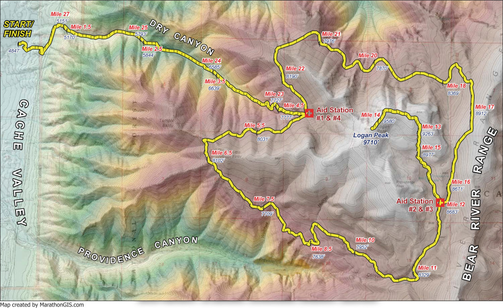 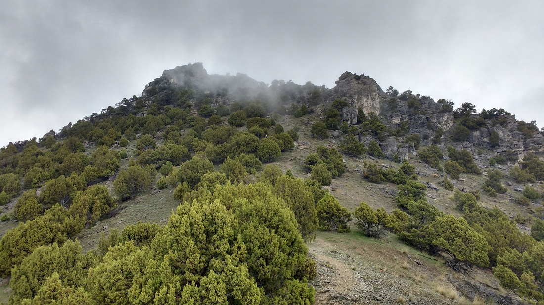 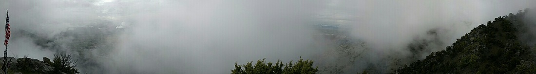 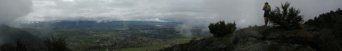 Today was the day, we were going to get up to that flag. This is one of the shorter but challenging local climbs, especially if your goal is to climb efficiently. Some days I nail the climbing jog, where it feels borderline effortless. This was not one of those days. Even my power hike seemed labored, as I climbed up the steep hill slope in search of the recently replaced flag. If you are considering a trip up to the flag, you should definitely do it. The view of the valley is gorgeous. The fog, on this particular day, blew in and out of the area providing a glimpse of those carrying on their day below followed by an eerily empty void surrounding us. The rugged dark rock gives the feeling that you are on another planet. This trail adventure is roughly a mile each way with 1,542 feet of climbing. It is accessed by parking at the mouth of Providence Canyon and heading northward along the Bonneville Shoreline Trail (or Deerfence Trail). After a short climb out of the mouth of the canyon, you will see somewhat of a game trail that turns east off of the BST and starts climbing. 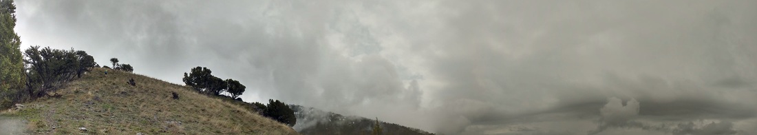
3:55am – watch alarm goes off 4:00am – making coffee, eggs and toast, eating banana and slowly getting dressed…. Current temp – cold….shorts or tights, that’s the question this fine morning. I put on my shorts with warm pants over them and packed the tights just in case. 4:50am – on the road to pick up Matt and head down to the Island 6:30ish – checked in, waiver signed and we have our numbers…brrrrr…. I felt for the awesome volunteers that morning! It’s one thing to be running when it is chilly out, but to stand in place it is certainly much more difficult to keep warm.  Arriving at start, we parked and I proceeded to finish my egg sandwich, hoping that it would sit well. I made a quite trip to the bathroom before there was a line and returned to the car to stay warm. As the start time grew closer, I stripped off the warm pants, reluctantly, and made sure I had all the food in my pack that I had intended. I made the final decision to go with the shorts over the tights, and hoped it would warm up pretty quickly. I took one last trip to bathroom around 20 minutes to the start (only had one cup of coffee this morning, so race anxiety I guess). At about 10 minutes prior to race time, I mustered up the courage to leave the warm car and head over to the fire pit. It was actually quite toasty, until we were called over for the pre-race briefing. We got a quick overview of the course (none of which I was likely to remember, except for the bit about everything being well marked…..and it was!) The rest of this adventure report will be more in mileage, because hell if I took note of the time throughout the run. The race started with a pleasant slight downhill out of the start area along a dirt road, then took an almost 180 turn and started a mellow climb up the nearby hill. I felt great, with a good pace – not pushing too hard, but probably not as slow starting as I should have. It was wonderful to get moving and the feet warmed up quickly. I, of course, needed to pee, but not too terrible – hoped for a bathroom at first aid station Somewhere along this stretch, The Eagles (yes, the band…this isn’t some sort of magical play on words describing the birds) were playing behind me….Peaceful Easy Feeling, I think. Thanks Michele (Mama) Snow for the tunes. Luckily, I would get sporadic and much appreciated music breaks through the rest of the run. (On a separate note, this amazing lady – Michele - had a busted rib throughout most of the race, but still had a smile and amazing attitude every time I saw her!)
We also saw a buffalo somewhere along this stretch, just hanging out off in the distance. I thought to myself briefly, I wonder if someone road one in to the finish, would that count? Hmm…. I know, silly. Had I spotted any closer to the last stretch, I probably would have given it more serious consideration. Elephant Head Aid station ~ 5.5 mi - First aid station (after a short climb) – I caught up with Matt here…losing layers as the temp is warming up and the sun feels nice. Happy aid station volunteers offering goods – no need just yet but appreciated them!  Somewhere around mile 11 – where I was expecting the monster climb to commence, we hit a trail section that was quite the combination of surfaces. It alternated between larger cobble (river stone-like), then what seemed like newly added gravel, and deeper gray sand. If it was a longer stretch, I probably would have cursed it, but because it kind of alternated a bit and was relatively brief, it was actually kind of nice. It seemed to work the legs differently. The scenery also didn’t suck too badly, so there was that. (For the record, if you ever have the opportunity to explore the western side of the island, jump at it. It was absolutely stunning. It seemed like we were in a different place, not Utah…for sure….and maybe not even on earth. Just spectacular. 
Nine Mile Gate – this station was found at the top of the one climb I took a mental note of during my strava reviews – I knew (if I was looking at the same or similar course) that there was a helluva climb between mile 11 – 14, and it did not disappoint. I was glad to have known about it. Tried to eat a cookie (which was delicious) but could tell after the first bite it wasn’t going to sit well – didn’t finish it (but thx for the homemade cookie effort though!) – had two electrolyte capsules upon the offering of one of the volunteers – not sure if it was something I looked like I needed or just offered to everyone, but knowing that sometimes I start to cramp later in a long run, figured it wouldn’t hurt (yep, broke that cardinal rule of not trying anything new during a race….well, this time, it didn’t bite me in the ass). I can’t say for sure if they helped but I think they may have. Onward through a flat-ish rocky section with a brief additional climb and then a nice downhill stretch. I was alone for what seemed like a while here, after Matt flew off on the downhill. (I was always happy to catch a glimpse of an arrow just to make sure I didn’t manage to wonder off track). The last stretch was mostly flat with gradual up and down along the shoreline. For me this was probably the toughest as you could see down the shoreline for what seemed like forever…and knowing you had to travel all that way. I decided that the occasional glances to take in the gorgeous views were needed as much as burying my head down into the trail and plugging away….. letting my thoughts wander to this and that…what are the kiddos and H doing…..gosh it’s a damn nice day….what the hell am I doing….and then for long stretches, nothing at all, beyond studying the surface of the trail. I would occasionally think, man I am tired….should just walk for a bit….then (all internally, but yes, sometimes these questions are asked out loud) I would ask myself, are you hurt…I mean, yes you are sore, but are you injured….is there anything really wrong….if the answer is no, this is all in your head…just plug away. Slow down if needed, but don’t stop. It’s funny how easy it can be to talk ourselves in and out of things. I occasionally looked down at my watch to see roughly how much longer I had. I had to approximate because I knew a mile or so had been added to the race to make it longer….but I had failed to recall how long it was in the first place…….somewhere between 29 and 31ish miles I told myself. I could tell my legs were getting tired because my form was starting to lack (likely why my feet were quite sore toward the end). North Sentry – coke, pickle, handheld water refill (thanks volunteers for topping her off for me!) I have never tried pop during a race…but coke always seem to settle my stomach during a hangover….seemed like a good idea. Again, it happened to be just that. The carbonated goodness felt good on the palate and the sugar kick may have powered me through the next three miles and on to the next and final aid station. Lower Frary – coke, a visit with Michelle (or Mama) Snow, no water refill needed. Now, it was time to press on through the final stretch along the shoreline. I received a quick high five from a woman who was busting out a nice pace for the last stretch and just cruised right on by me. I was impressed but maintained my slow and steady. Eventually, there was a short climb up to the road and across, and then a longer climb on a large dirt road. Pavement, bah (whomever complained and got that added on, I definitely cursed you a few times during that final stretch). I kept reminding myself to just keep moving, look down at the ground if you need to and don’t worry about how much there still seems to be left in front of you. At this point, the course ran past the parking area and the finish line and looped back around to return to the finish in the reverse of our start. It was a welcome sight, despite the fact that we basically ran past it and looped back around to it. I am not sure if I am just a complete trail snob these days or what, but pavement just takes the wind right out of my sails, every time. I know most folks are speedy on pavement, but for me, it is the opposite. I am sure I am forgetting something, but all in all it was an amazing day filled with beautiful trails and scenery, wonderful volunteers out there providing support, and determined fellow runners running their race and immersed in their own adventure. Upon the finish, I was happy to be there but couldn’t help but think I could have given a little more and shaved some time. There is that ever present balance of feeling like you pushed as hard as you could without bonking or not finishing that I don’t know that I have figured out just yet. The chili was amazing and certainly hit the spot.. I know there is history behind the medals and belt buckles but I think the finishers mug is the best. 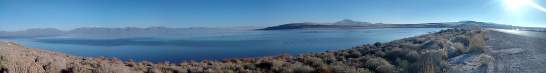 Shoes: Altra Lone Peak 2.5 Pack: Nathan Vapor Shape Sustenance: Tailwind (started the run with 400 calories worth in my handheld - tastes like a liquid version of a smartie), Kind Bars, a couple Hammer Gels, chips, pretzels, 2 electrolyte capsules, and 2 small cups of coke during the final two aid stations stops. I also started with 2L of water in my pack so I never had to worry about running out in between stations. Buffalo run adventures website: http://www.buffalorunadventures.com I was up at 5:30 am in anticipation of an exciting day ahead! I had checked the SNOTEL reading for Tony Grove last evening and it still showed an inch of accumulation. With that in mind, I knew there would be at least a few inches up higher and realized this could make for more of a Winter hike that a Fall run. 7:00 am - Rob and I met at Green Canyon, as planned, to drop off a vehicle and secure our final plan. With the snow in mind, we had discussed the possibility of changing our plan to an out and back from Green Canyon, however, the best adventures tend to commence with something along the lines of.....ah, what the hell. We drove to Cove, just north of Richmond and headed toward the High Creek trail head. If you haven't had the opportunity to explore this area, you should definitely check in out. It isn't that far from Logan and is absolutely beautiful.
8:30 am - Here we began our journey on foot. It was cool and a bit damp from the recent rain but still free of snow. There were a number of creek crossings at the start, the first of which, I managed to step right into ankle deep. (Yay, go me! Ha ha ....jackass) With some concern about starting such an adventure with cold wet feet, I decided I would make a call in the next few miles. As we ran, my feet warmed right up and those concerns faded (thanks awesome injinji toe socks)
We followed possible fox and deer tracks into the snow as we ascended toward High Creek Lake. High Creek Lake was beautiful and cooooold (windy). We took a few photos as I sung about tiggers being wonderful things (since their tops are made outta rubber, and their bottoms are made out of springs), and proceeded onward to the trail split for Naomi and Cherry Peak. 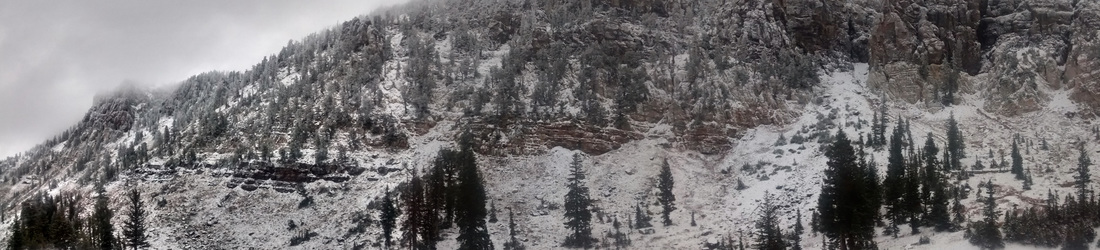
Quick stop at what will be now referred to as the pee tree for a picture of the sign, then the haul up to Cherry.
As we climbed to Cherry Peak, we admired how quickly the sky changed with the rapidly moving clouds and fog. We heard a series gun shots and inferred that they were practicing, a terrible shot, or there was nothing left of that deer. Upon our summit, the clouds seemed to have settled on the peak, with an eerie unknown grey-ness surrounding us. It was surprisingly still, as we paused to capture proof of our first summit of the day. 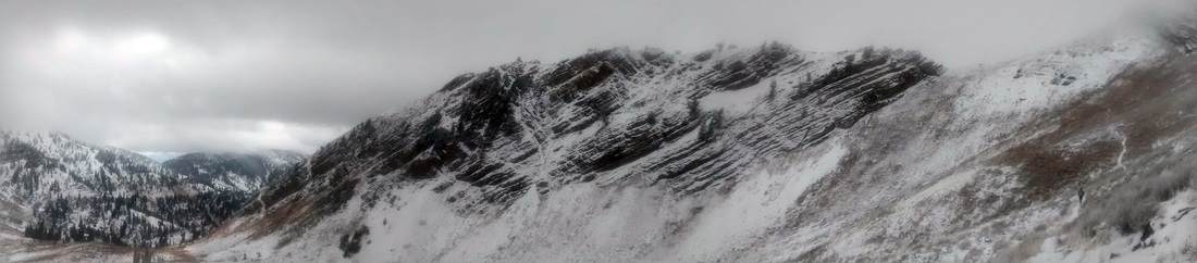 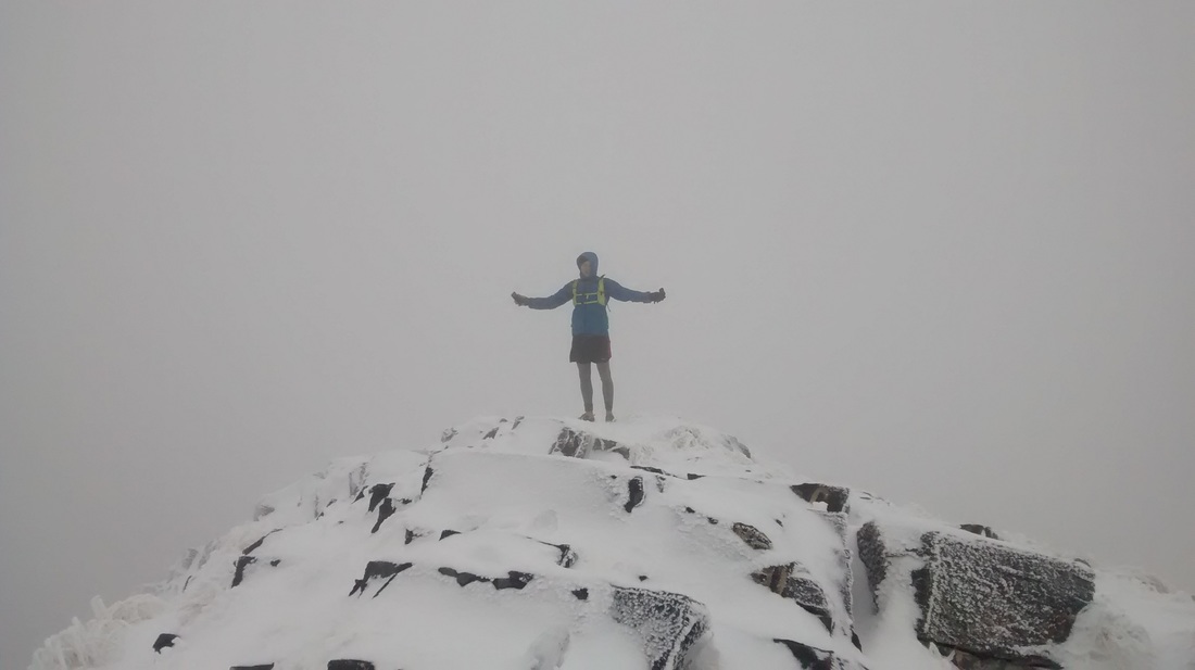 We made our way back down to the sign (and pee tree) and happily proceeded on toward Mount Naomi. I am pretty sure we encountered the deepest snow along this stretch, with a couple of sketchy sections (meaning, careful steps and no desire to go down a steep slide....forgot the sleds at home). As we crossed over the ridge line for the final approach to Naomi, we hit a patch of warm clouds/fog. It was a welcome experience, as it felt as though we ran through the Fall, straight through Winter, and were now entering a warmish bit of Spring. After a little scramble we were on the summit, taking our pictures and leaving a note for the next ascenders (what? I just wrote hello....no dirty drawings in the snow... sheesh) 
  The run down from Naomi was nothing short of a happy frolick through the snow, with a few pauses for pictures of the once again, ever changing sky. The sun gave the snow on the distant ridges a magical glow (that's right...magical....and I was sober). The magic took a temporary hiatus when I realized that I dropped my phone somewhere. We backtracked up trail for a while, hoping that it was somewhere visible and that the only hiker we had seen thus far had not picked it up. This will be known as Lauren's jackass moment number two of the day. (For the record, I felt pretty confident that it was a goner, tucked under a thin layer of snow and just of out sight.) With a little bit of luck (or maybe a lot), I found the phone, just the edge of it sticking out of the snow. I let out a holler of success and proceeded back down trail to find Rob. We actually ran into quite a few more folks adventuring up trail as we made our way down to Tony Grove Lake.
Upon arriving at Tony Grove lake, we visited with a group of folks geared up for some spelunking in the nearby Polygamist Cave. We plopped down in the lake overlook, stripped off the soaked socks and shoes and aired out the toes for a few. The sun felt great but the wind was still damn cold. I was happy to throw on my down jacket and keep the core toasty while we ate and marveled on our progress, despite the elements. After sitting for a few, my legs started to charlie horse. Rob brought coconut butter so I wolfed down some of that along with my (super healthy) nutty buddy bars. Amazingly enough, the charlie horses faded quickly and we were on our way over to fill up and purify some lake water (cold fingers!) As a funny visual for all of you, that we didn't photo document, we realized that from the other side of the lake, it likely appeared that I was holding up a dromedary for Rob to pee into. We had a good laugh on that, while trying not to spill our freshly filtered water. Onward we ventured into Tony Grove Campground looking for the section of trail that would link with the back country trail. The campground was cool and dark, making it suddenly feel much later than it was. Along the switchbacks up and out of the area, the sun managed to peak through and make the snow on the pine trees sparkle.... a little more magic for the day. We eventually made it to what I described as "a meadow" from my somewhat recent memory's run with Matt through this area. A meadow would imply that it was somewhat flat - not so much. It was uphill all the way to the sign and would have been run-able if not for the running water through the area making it a muddy mess. We opted to jog through the sage off trail to get up to the sign where the trail splits. We opted to experience the 7 sisters because it comes highly recommended and of course, I thought this would be an easier effort late in the day than the other avenue (staying low and just climbing near Elmer.)  Now, if you have gone running or backpacking with me, we can probably agree that my mental interpretations of elevation profiles is wack and my memory of recently traveled trails is horseshit. With this in mind, you can imagine how the 7 Sisters went - they chewed us up and spit us out on the other side. They provided us with gorgeous but brutal climbs (with lovely intermittent downhill sections, all too brief for my liking). Each time we finished one, there was another happily waiting for us (as if to say, oh.... you thought that was it, along with a clever sounding mountain chuckle....whatever that would sound like.) I had envisioned more of a rolling ridge line, with more mellow descents and ascents. Needless to say, I think we were pretty happy to finally arrive at the base of Elmer and proceed onward to Fudd, choosing to save the Elmer Summit for another day.
Reaching the sign for Beirdneau was another morale booster, reminding us that we had arrived at the last leg of our journey.
From here we had nice packed trail briefly and then proceeded to ski through the mud and slop down almost all the way to the (still running) spring. My GPS watch died somewhere along this stretch and I powered up strava on my phone. Hey, they say if it isn't on strava, it didn't happen, so.....
Phone blows up briefly with missed messages, calls, and emails. We trucked (on tired legs) down into and through Green Canyon, passing one hiker along the way. 7-730 pm - The trail was getting darker, and here we arrive at Lauren's third and final jackass moment of the day.....leaving the headlamp behind. We were able to see just well enough to stay on trail for the first couple sections but finally opted to hop on the road and power walk it down to the car (as opposed to tripping and breaking my fall with my face). Lesson learned and appears to be one that I have to re-learn once every couple of years. We reached car, or more accurately, Rob reached the car and I almost continued on right past her. Success! We made a few calls and let everyone know we were back to civilization, safe and sound. (Sorry Erin, Joni, mom, Nicole, and Mo for the worry...) Perhaps SPOT will send me a device to gear test for them and write a review. Eh? We loaded up and made our way to Carl's Junior for some greasy and fast sustenance to get us through the drive back to the High Creek trail head for Rob's truck and then back home to Logan. (Had I thought ahead and brought a sleeping bag, I would have slept right there in the old Element.) (Robert, the Bear "RawBearToe" and the Crow (due to the crow-like noises I make when almost falling . . . all the time) Shoes: Altra Lone Peak 2.5 Pack: Ultimate Direction Fastpack 20 Sustenance: Tailwind, Kind Bars, Honey Stinger fruit snacks, coconut butter, Nutty (buddy) bars All Lauren's Photos from this adventure All Robert's Photos from this adventure 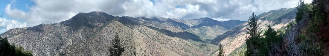 October 20, 2015 This is wonderful sub-16 mile loop that starts at the King Nature Park. From the park, you can run the nature park trail until you pick up the main Green Canyon trail. At approximately 2.5 miles from the start, you will turn off the main Green Canyon trail to access the Preston Valley trail. This trail climbs up and over the ridge where you can either head toward Beirdneau Peak or down to connect with the Wind Caves trail. For this particular adventure, I opted to head down to the Wind Caves trail, cross Highway 89 to Guinavah - Malibu Campground, and pick up the River Trail. Once on the River Trail, you are able to follow it all the way to the mouth of Logan Canyon where it connects with the Bonneville Shoreline Trail (BST). Simply finish the loop by returning to the mouth of Green Canyon via the BST. For this particular adventure, I opted to head down to the Wind Caves trail, cross Highway 89 to Guinavah - Malibu Campground, and pick up the River Trail. Once on the River Trail, you are able to follow it all the way to the mouth of Logan Canyon where it connects with the Bonneville Shoreline Trail (BST). Simply finish the loop by returning to the mouth of Green Canyon via the BST. Shoes: Altra Lone Peak 2.5 Pack: Nathan Vapor Shape Sustenance: Two Kind Bars (I did consume a large bowl of lamb stew and 2 T of coconut butter ~ 1 hour prior to departure.) 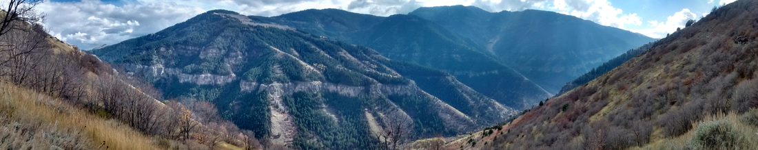 September 19, 2015
It was a crisp cool morning, however, not quite as cold as we were expecting. This meant the Winter hats we had discussed the night prior, were not needed. We met at the Green Canyon main parking lot to carpool up to the top where the road ends. The group was on trail by about 6:30 AM. The section of trail up to the split and sign for Beirdneau Peak was familiar to all of us. The sun decided to join us as we turned toward Mount Elmer. Just after Elmer, we ended up unintentionally splitting up as two members took the Seven Sisters route and Matt and I scrambled down the hillside in search of the target trail, referred to as the Mountain Naomi Peak trail (#005) on the current National Geographic map for the Logan Bear River Range. We successfully located the trail and followed it down toward Cottonwood Canyon. (Note: there is a campsite just before the Seven Sisters stretch where, if you proceed east you can locate the actual trail and follow the switchbacks downward. Matt and I only found it on the return trip as it does seem to fade away just before this primitive camp.) As we followed the trail down into the pine trees, it crossed a few washes and down trees but was still easy to find. Our intention was to loop the trails shown on CalTopo just before arriving at the Tony Grove backcountry trail head. We instead run up a trail that followed Blind Hollow and looped back to the main trail. We encountered quite a few folks on horses along the way. We returned to the car via the same trail. Matt arrived about 45- 60 minutes ahead of me. The uphill portion of the return, just before Mount Elmer, was a struggle for me mentally as I had run out of water and was not looking forward to the climb. (I may have psyched myself out a bit as we ran down it, as it seemed like such a nice long downhill. I discovered that, with a second wind, it didn't seem nearly as long of as a climb as I had expected. Sadly, I failed to bring my phone and camera for this one. I supposed this means I may need to do it again soon. If you are interested, please feel free to follow the links for the target trail mapped using CalTopo versus the actual run GPS-ed and uploaded to Strava. Shoes: Hoka One One Stinson Trail (discontinued older model) Pack: Nathan Vapor Shape Sustenance: For this adventure, I strayed from my usual handheld bottle with about 200 calories of Tailwind. I think this was a mistake as I underestimated the calories needed and this added to my deficit. I did feast on Kind Bars, Scratch Labs fruit snacks, and a few of Joni's magical peanut butter balls along the way. |


Archives
September 2016
Categories
|


 RSS Feed
